
K32A Verdigre, NE, USA - Earthquake Result Viewer
| ||||||||||||||||||
| ||||||||||||||||||
| ||||||||||||||||||
|
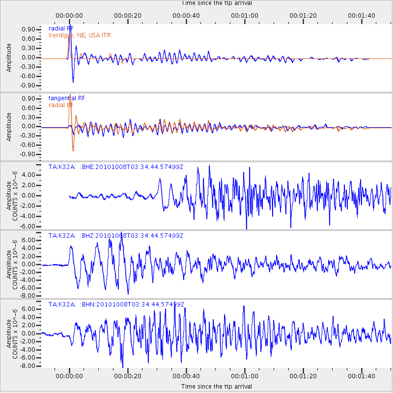
Signal To Noise
| Channel | StoN | STA | LTA |
| TA:K32A: :BHZ:20101008T03:34:44.57499Z | 22.118519 | 3.1009856E-6 | 1.4019861E-7 |
| TA:K32A: :BHN:20101008T03:34:44.57499Z | 5.949759 | 1.7229594E-6 | 2.8958473E-7 |
| TA:K32A: :BHE:20101008T03:34:44.57499Z | 5.954281 | 1.8593395E-6 | 3.1226938E-7 |
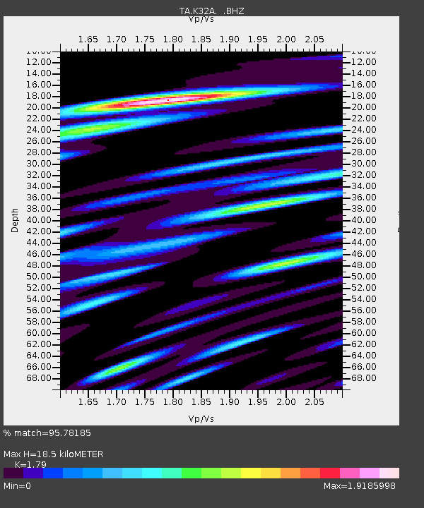
| Arrivals | |
| Ps | 2.4 SECOND |
| PpPs | 7.5 SECOND |
| PsPs/PpSs | 9.9 SECOND |

