J32A Parkston, SD, USA - Earthquake Result Viewer
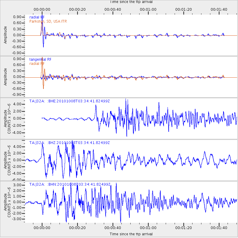
Earthquake location: Andreanof Islands, Aleutian Is.
Earthquake latitude/longitude: 51.4/-175.4
Earthquake time(UTC): 2010/10/08 (281) 03:26:13 GMT
Earthquake Depth: 19 km
Earthquake Magnitude: 6.2 MB, 6.3 MS, 6.4 MW, 6.2 MW
Earthquake Catalog/Contributor: WHDF/NEIC
Network: TA USArray Transportable Network (new EarthScope stations)
Station: J32A Parkston, SD, USA
Lat/Lon: 43.37 N/97.85 W
Elevation: 399 m
Distance: 50.8 deg
Az: 66.738 deg
Baz: 307.845 deg
Ray Param: 0.06778999
Estimated Moho Depth: 30.5 km
Estimated Crust Vp/Vs: 1.77
Assumed Crust Vp: 6.498 km/s
Estimated Crust Vs: 3.676 km/s
Estimated Crust Poisson's Ratio: 0.26
Radial Match: 91.62935 %
Radial Bump: 400
Transverse Match: 77.58668 %
Transverse Bump: 400
SOD ConfigId: 339645
Insert Time: 2011-02-10 08:10:52.706 +0000
GWidth: 2.5
Max Bumps: 400
Tol: 0.001

Signal To Noise

ChannelStoNSTALTA
TA:J32A: :BHZ:20101008T03:34:41.82499Z10.7413482.7319184E-62.543366E-7
TA:J32A: :BHN:20101008T03:34:41.82499Z6.6130499.699735E-71.4667567E-7
TA:J32A: :BHE:20101008T03:34:41.82499Z8.9698711.6535733E-61.8434751E-7
Arrivals
Ps3.8 SECOND
PpPs12 SECOND
PsPs/PpSs16 SECOND