
J31A Geddes, SD, USA - Earthquake Result Viewer
| ||||||||||||||||||
| ||||||||||||||||||
| ||||||||||||||||||
|
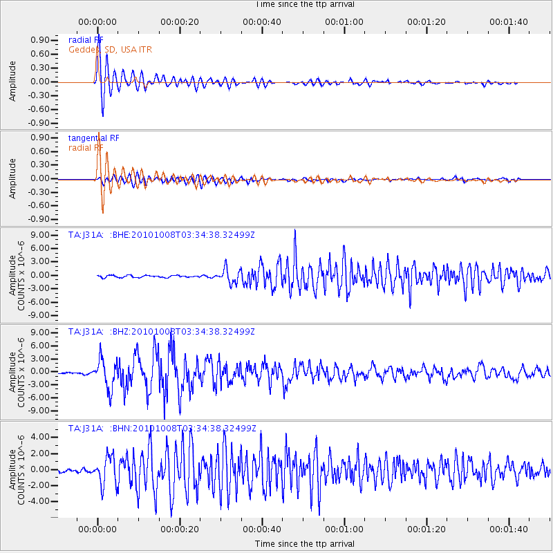
Signal To Noise
| Channel | StoN | STA | LTA |
| TA:J31A: :BHZ:20101008T03:34:38.32499Z | 23.142746 | 3.4512748E-6 | 1.4912987E-7 |
| TA:J31A: :BHN:20101008T03:34:38.32499Z | 6.808707 | 1.7879479E-6 | 2.6259727E-7 |
| TA:J31A: :BHE:20101008T03:34:38.32499Z | 6.9845934 | 1.593793E-6 | 2.2818695E-7 |
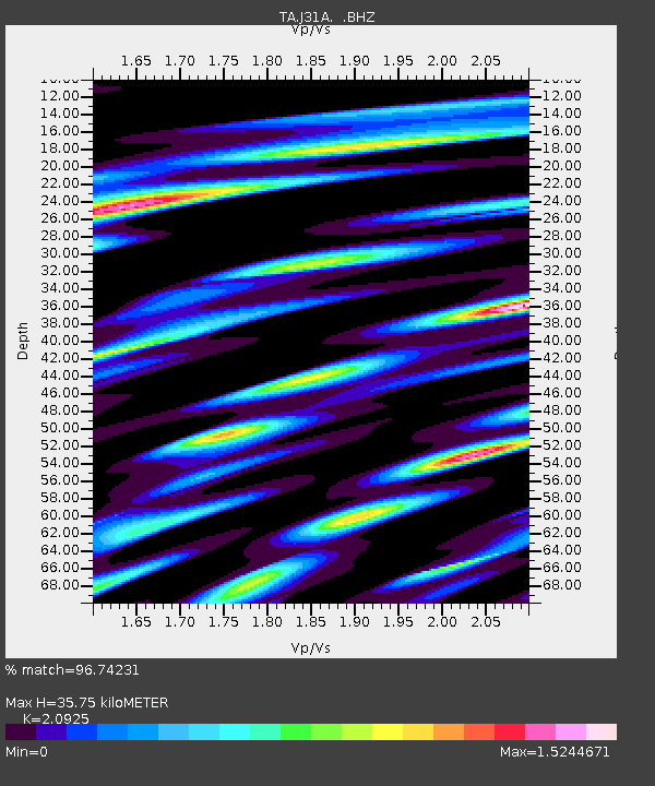
| Arrivals | |
| Ps | 6.3 SECOND |
| PpPs | 16 SECOND |
| PsPs/PpSs | 22 SECOND |

