O02D Mt. Diablo Meridian, CA, USA - Earthquake Result Viewer
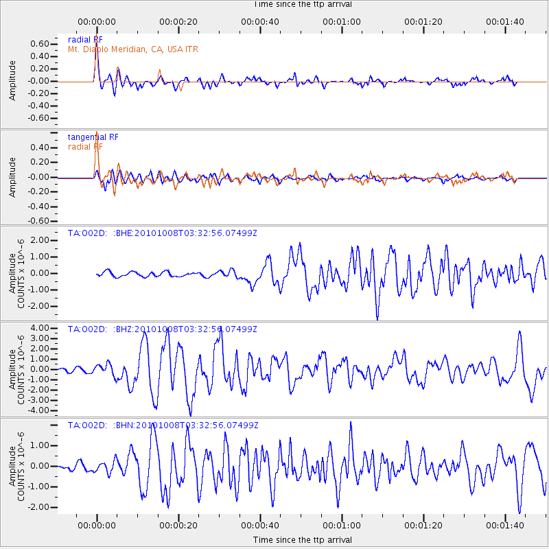
Earthquake location: Andreanof Islands, Aleutian Is.
Earthquake latitude/longitude: 51.4/-175.4
Earthquake time(UTC): 2010/10/08 (281) 03:26:13 GMT
Earthquake Depth: 19 km
Earthquake Magnitude: 6.2 MB, 6.3 MS, 6.4 MW, 6.2 MW
Earthquake Catalog/Contributor: WHDF/NEIC
Network: TA USArray Transportable Network (new EarthScope stations)
Station: O02D Mt. Diablo Meridian, CA, USA
Lat/Lon: 40.18 N/122.79 W
Elevation: 965 m
Distance: 37.6 deg
Az: 86.243 deg
Baz: 305.283 deg
Ray Param: 0.07604049
Estimated Moho Depth: 16.5 km
Estimated Crust Vp/Vs: 2.10
Assumed Crust Vp: 6.566 km/s
Estimated Crust Vs: 3.13 km/s
Estimated Crust Poisson's Ratio: 0.35
Radial Match: 85.96073 %
Radial Bump: 362
Transverse Match: 77.27855 %
Transverse Bump: 400
SOD ConfigId: 339645
Insert Time: 2011-02-10 08:11:59.232 +0000
GWidth: 2.5
Max Bumps: 400
Tol: 0.001

Signal To Noise

ChannelStoNSTALTA
TA:O02D: :BHZ:20101008T03:32:56.07499Z3.551115.731874E-71.6141075E-7
TA:O02D: :BHN:20101008T03:32:56.07499Z2.29444312.8426044E-71.2389083E-7
TA:O02D: :BHE:20101008T03:32:56.07499Z1.51717422.0974717E-71.3824858E-7
Arrivals
Ps2.9 SECOND
PpPs7.3 SECOND
PsPs/PpSs10 SECOND