K02D Willamette Meridian, OR, USA - Earthquake Result Viewer
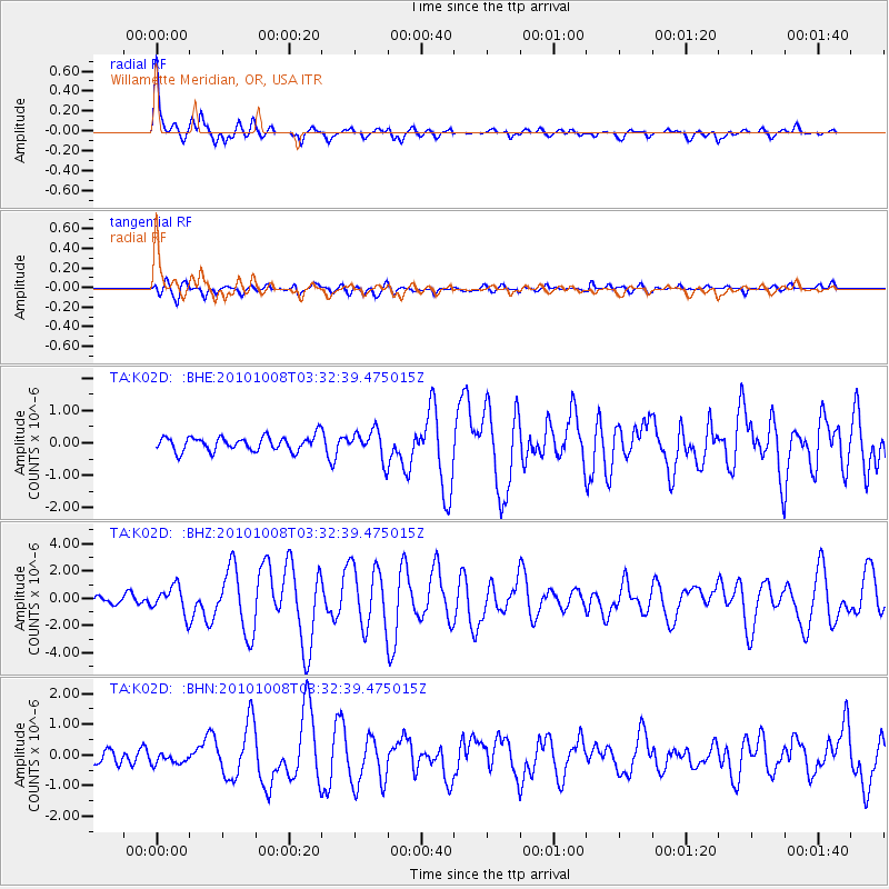
Earthquake location: Andreanof Islands, Aleutian Is.
Earthquake latitude/longitude: 51.4/-175.4
Earthquake time(UTC): 2010/10/08 (281) 03:26:13 GMT
Earthquake Depth: 19 km
Earthquake Magnitude: 6.2 MB, 6.3 MS, 6.4 MW, 6.2 MW
Earthquake Catalog/Contributor: WHDF/NEIC
Network: TA USArray Transportable Network (new EarthScope stations)
Station: K02D Willamette Meridian, OR, USA
Lat/Lon: 42.70 N/123.67 W
Elevation: 989 m
Distance: 35.6 deg
Az: 83.353 deg
Baz: 302.384 deg
Ray Param: 0.077102065
Estimated Moho Depth: 16.0 km
Estimated Crust Vp/Vs: 1.94
Assumed Crust Vp: 6.522 km/s
Estimated Crust Vs: 3.357 km/s
Estimated Crust Poisson's Ratio: 0.32
Radial Match: 89.95162 %
Radial Bump: 400
Transverse Match: 62.351395 %
Transverse Bump: 400
SOD ConfigId: 339645
Insert Time: 2011-02-10 08:12:23.048 +0000
GWidth: 2.5
Max Bumps: 400
Tol: 0.001

Signal To Noise

ChannelStoNSTALTA
TA:K02D: :BHZ:20101008T03:32:39.475015Z3.38073139.87147E-72.9199214E-7
TA:K02D: :BHN:20101008T03:32:39.475015Z0.550510171.9010282E-73.4532118E-7
TA:K02D: :BHE:20101008T03:32:39.475015Z1.98139724.3859004E-72.2135393E-7
Arrivals
Ps2.5 SECOND
PpPs6.7 SECOND
PsPs/PpSs9.2 SECOND