You are here: Home > Network List > AZ - ANZA Regional Network Stations List
> Station CRY AZ.CRY > Earthquake Result Viewer
CRY AZ.CRY - Earthquake Result Viewer

| Earthquake location: |
El Salvador |
| Earthquake latitude/longitude: |
13.0/-88.7 |
| Earthquake time(UTC): |
2001/01/13 (013) 17:33:32 GMT |
| Earthquake Depth: |
60 km |
| Earthquake Magnitude: |
6.4 MB, 7.8 MS, 7.7 MW, 7.5 ME |
| Earthquake Catalog/Contributor: |
WHDF/NEIC |
|
| Network: |
AZ ANZA Regional Network |
| Station: |
CRY AZ.CRY |
| Lat/Lon: |
33.57 N/116.74 W |
| Elevation: |
1128 m |
|
| Distance: |
32.7 deg |
| Az: |
313.352 deg |
| Baz: |
121.932 deg |
| Ray Param: |
0.07839759 |
| Estimated Moho Depth: |
43.75 km |
| Estimated Crust Vp/Vs: |
1.97 |
| Assumed Crust Vp: |
6.264 km/s |
| Estimated Crust Vs: |
3.175 km/s |
| Estimated Crust Poisson's Ratio: |
0.33 |
|
| Radial Match: |
97.253914 % |
| Radial Bump: |
322 |
| Transverse Match: |
82.1371 % |
| Transverse Bump: |
400 |
| SOD ConfigId: |
3744 |
| Insert Time: |
2010-02-26 19:02:05.020 +0000 |
| GWidth: |
2.5 |
| Max Bumps: |
400 |
| Tol: |
0.001 |
|
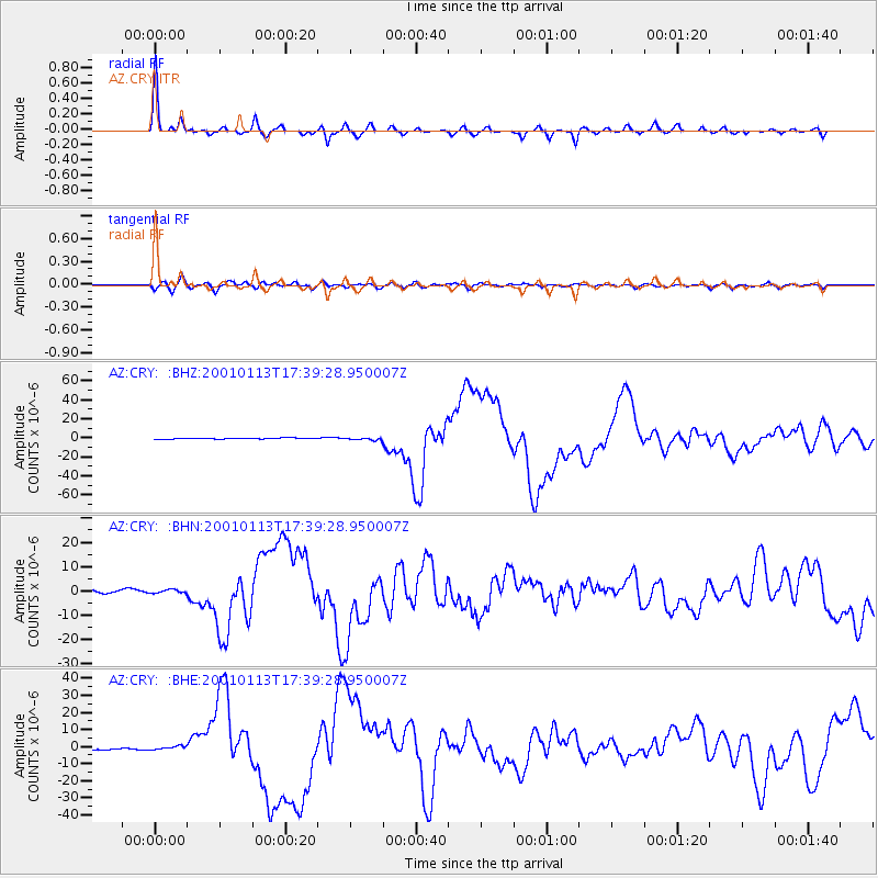
Signal To Noise
| Channel | StoN | STA | LTA |
| AZ:CRY: :BHN:20010113T17:39:28.950007Z | 1.33324 | 6.9886784E-7 | 5.241876E-7 |
| AZ:CRY: :BHE:20010113T17:39:28.950007Z | 2.3743892 | 1.011969E-6 | 4.2620178E-7 |
| AZ:CRY: :BHZ:20010113T17:39:28.950007Z | 2.4822428 | 1.3060809E-6 | 5.261697E-7 |
| Arrivals |
| Ps | 7.3 SECOND |
| PpPs | 19 SECOND |
| PsPs/PpSs | 27 SECOND |


