H04D Lebanon, OR, USA - Earthquake Result Viewer
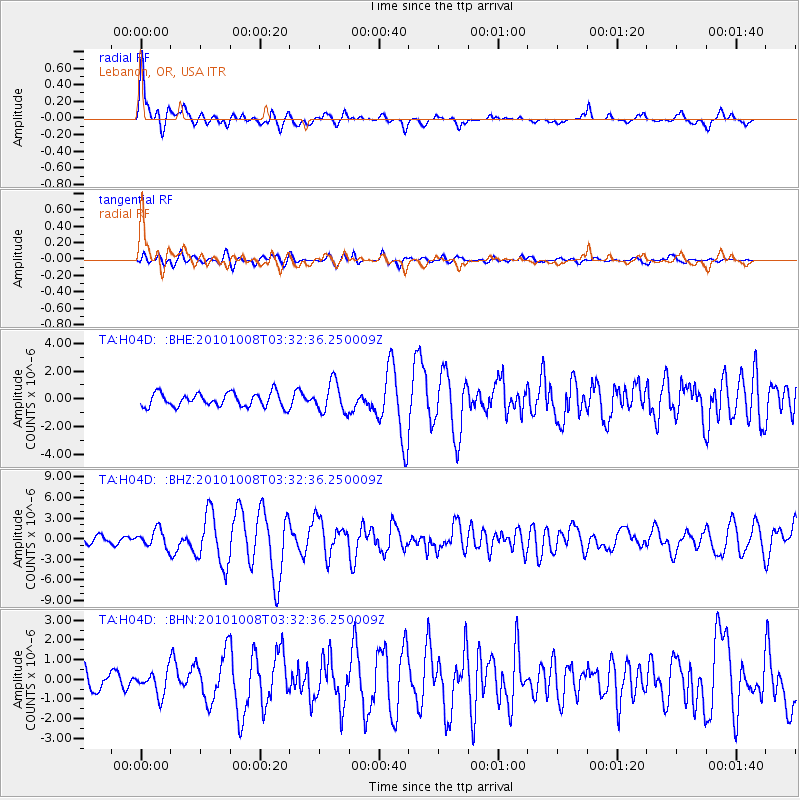
Earthquake location: Andreanof Islands, Aleutian Is.
Earthquake latitude/longitude: 51.4/-175.4
Earthquake time(UTC): 2010/10/08 (281) 03:26:13 GMT
Earthquake Depth: 19 km
Earthquake Magnitude: 6.2 MB, 6.3 MS, 6.4 MW, 6.2 MW
Earthquake Catalog/Contributor: WHDF/NEIC
Network: TA USArray Transportable Network (new EarthScope stations)
Station: H04D Lebanon, OR, USA
Lat/Lon: 44.52 N/122.74 W
Elevation: 284 m
Distance: 35.2 deg
Az: 80.056 deg
Baz: 300.335 deg
Ray Param: 0.07730231
Estimated Moho Depth: 40.5 km
Estimated Crust Vp/Vs: 1.98
Assumed Crust Vp: 6.566 km/s
Estimated Crust Vs: 3.325 km/s
Estimated Crust Poisson's Ratio: 0.33
Radial Match: 80.60471 %
Radial Bump: 400
Transverse Match: 70.00133 %
Transverse Bump: 400
SOD ConfigId: 339645
Insert Time: 2011-02-10 08:12:47.895 +0000
GWidth: 2.5
Max Bumps: 400
Tol: 0.001

Signal To Noise

ChannelStoNSTALTA
TA:H04D: :BHZ:20101008T03:32:36.250009Z2.75155541.269235E-64.6127906E-7
TA:H04D: :BHN:20101008T03:32:36.250009Z1.32547976.025519E-74.5459157E-7
TA:H04D: :BHE:20101008T03:32:36.250009Z2.18330431.0710938E-64.9058383E-7
Arrivals
Ps6.5 SECOND
PpPs17 SECOND
PsPs/PpSs24 SECOND