
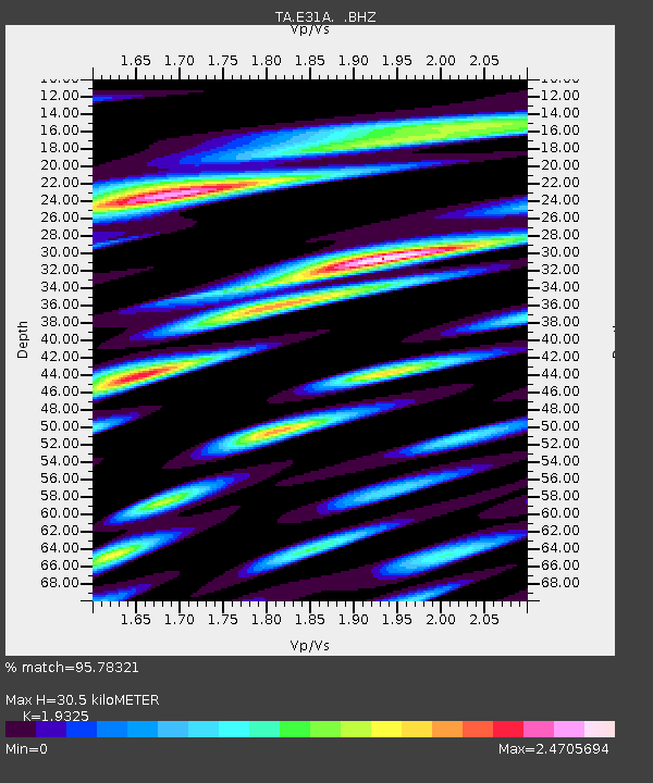
E31A Nome, ND, USA - Earthquake Result Viewer
| ||||||||||||||||||
| ||||||||||||||||||
| ||||||||||||||||||
|
Signal To Noise
| Channel | StoN | STA | LTA |
| TA:E31A: :BHZ:20101008T03:34:27.174996Z | 13.83277 | 3.561111E-6 | 2.5744018E-7 |
| TA:E31A: :BHN:20101008T03:34:27.174996Z | 4.6662307 | 2.157302E-6 | 4.623222E-7 |
| TA:E31A: :BHE:20101008T03:34:27.174996Z | 7.855681 | 2.9088055E-6 | 3.7028047E-7 |
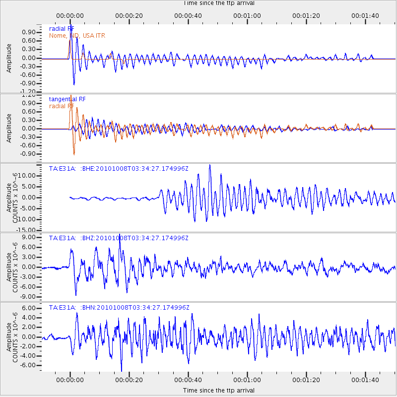
| Arrivals | |
| Ps | 4.6 SECOND |
| PpPs | 13 SECOND |
| PsPs/PpSs | 18 SECOND |

