
H31A Wolsey, SD, USA - Earthquake Result Viewer
| ||||||||||||||||||
| ||||||||||||||||||
| ||||||||||||||||||
|
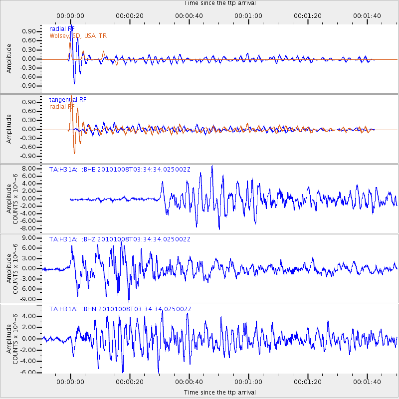
Signal To Noise
| Channel | StoN | STA | LTA |
| TA:H31A: :BHZ:20101008T03:34:34.025002Z | 13.982544 | 3.44734E-6 | 2.4654597E-7 |
| TA:H31A: :BHN:20101008T03:34:34.025002Z | 3.1923687 | 1.2159908E-6 | 3.8090548E-7 |
| TA:H31A: :BHE:20101008T03:34:34.025002Z | 9.529097 | 2.0955945E-6 | 2.1991534E-7 |
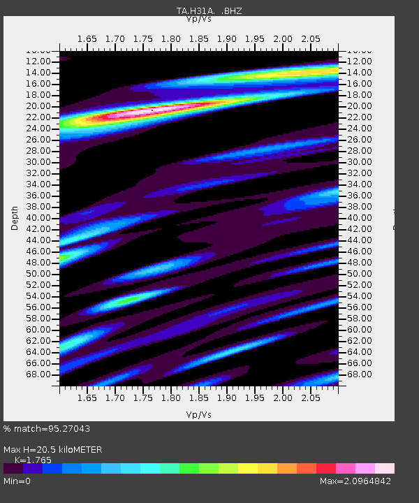
| Arrivals | |
| Ps | 2.6 SECOND |
| PpPs | 8.2 SECOND |
| PsPs/PpSs | 11 SECOND |

