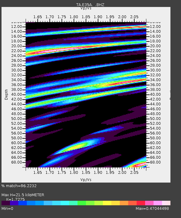
E35A Pequot Lakes, MN, USA - Earthquake Result Viewer

Earthquake location: Andreanof Islands, Aleutian Is.
Earthquake latitude/longitude: 51.4/-175.4
Earthquake time(UTC): 2010/10/08 (281) 03:26:13 GMT
Earthquake Depth: 19 km
Earthquake Magnitude: 6.2 MB, 6.3 MS, 6.4 MW, 6.2 MW
Earthquake Catalog/Contributor: WHDF/NEIC
Network: TA USArray Transportable Network (new EarthScope stations)
Station: E35A Pequot Lakes, MN, USA
Lat/Lon: 46.56 N/94.40 W
Elevation: 409 m
Distance: 50.8 deg
Az: 61.558 deg
Baz: 306.996 deg
Ray Param: 0.067785814
Estimated Moho Depth: 21.5 km
Estimated Crust Vp/Vs: 1.73
Assumed Crust Vp: 6.419 km/s
Estimated Crust Vs: 3.716 km/s
Estimated Crust Poisson's Ratio: 0.25
Radial Match: 96.2232 %
Radial Bump: 319
Transverse Match: 81.307846 %
Transverse Bump: 400
SOD ConfigId: 339645
Insert Time: 2011-02-10 08:14:03.174 +0000
GWidth: 2.5
Max Bumps: 400
Tol: 0.001

Signal To Noise

ChannelStoNSTALTA
TA:E35A: :BHZ:20101008T03:34:41.875009Z13.7638674.290244E-63.1170336E-7
TA:E35A: :BHN:20101008T03:34:41.875009Z5.90482231.6360217E-62.7706537E-7
TA:E35A: :BHE:20101008T03:34:41.875009Z13.5044212.5001857E-61.8513832E-7
Arrivals
Ps2.6 SECOND
PpPs8.6 SECOND
PsPs/PpSs11 SECOND