MIAR Mount Ida, Arkansas, USA - Earthquake Result Viewer
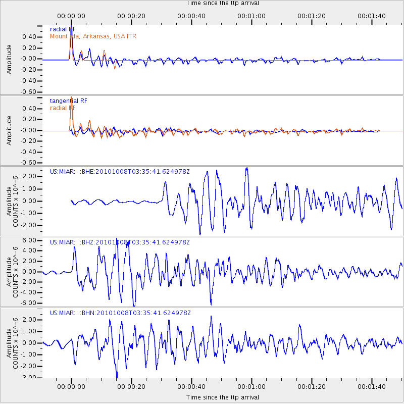
Earthquake location: Andreanof Islands, Aleutian Is.
Earthquake latitude/longitude: 51.4/-175.4
Earthquake time(UTC): 2010/10/08 (281) 03:26:13 GMT
Earthquake Depth: 19 km
Earthquake Magnitude: 6.2 MB, 6.3 MS, 6.4 MW, 6.2 MW
Earthquake Catalog/Contributor: WHDF/NEIC
Network: US United States National Seismic Network
Station: MIAR Mount Ida, Arkansas, USA
Lat/Lon: 34.55 N/93.58 W
Elevation: 207 m
Distance: 59.1 deg
Az: 72.226 deg
Baz: 313.69 deg
Ray Param: 0.06240106
Estimated Moho Depth: 20.75 km
Estimated Crust Vp/Vs: 1.95
Assumed Crust Vp: 6.498 km/s
Estimated Crust Vs: 3.328 km/s
Estimated Crust Poisson's Ratio: 0.32
Radial Match: 94.45502 %
Radial Bump: 358
Transverse Match: 90.45046 %
Transverse Bump: 400
SOD ConfigId: 339645
Insert Time: 2011-02-10 08:17:14.176 +0000
GWidth: 2.5
Max Bumps: 400
Tol: 0.001

Signal To Noise

ChannelStoNSTALTA
US:MIAR: :BHZ:20101008T03:35:41.624978Z9.9375872.2481186E-62.262238E-7
US:MIAR: :BHN:20101008T03:35:41.624978Z4.46819357.2096987E-71.6135601E-7
US:MIAR: :BHE:20101008T03:35:41.624978Z7.5907448.429663E-71.1105187E-7
Arrivals
Ps3.2 SECOND
PpPs9.0 SECOND
PsPs/PpSs12 SECOND