WMOK Wichita Mountains, Oklahoma, USA - Earthquake Result Viewer
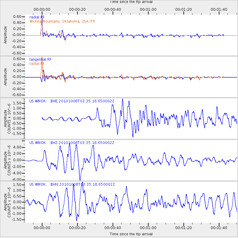
Earthquake location: Andreanof Islands, Aleutian Is.
Earthquake latitude/longitude: 51.4/-175.4
Earthquake time(UTC): 2010/10/08 (281) 03:26:13 GMT
Earthquake Depth: 19 km
Earthquake Magnitude: 6.2 MB, 6.3 MS, 6.4 MW, 6.2 MW
Earthquake Catalog/Contributor: WHDF/NEIC
Network: US United States National Seismic Network
Station: WMOK Wichita Mountains, Oklahoma, USA
Lat/Lon: 34.74 N/98.78 W
Elevation: 486 m
Distance: 55.8 deg
Az: 75.538 deg
Baz: 312.527 deg
Ray Param: 0.06452275
Estimated Moho Depth: 24.5 km
Estimated Crust Vp/Vs: 2.10
Assumed Crust Vp: 6.315 km/s
Estimated Crust Vs: 3.011 km/s
Estimated Crust Poisson's Ratio: 0.35
Radial Match: 92.89534 %
Radial Bump: 400
Transverse Match: 88.096855 %
Transverse Bump: 400
SOD ConfigId: 339645
Insert Time: 2011-02-10 08:17:15.300 +0000
GWidth: 2.5
Max Bumps: 400
Tol: 0.001

Signal To Noise

ChannelStoNSTALTA
US:WMOK: :BHZ:20101008T03:35:18.650002Z14.37746051.8151769E-61.2625156E-7
US:WMOK: :BHN:20101008T03:35:18.650002Z3.1153934.6454284E-71.4911213E-7
US:WMOK: :BHE:20101008T03:35:18.650002Z4.32284834.881047E-71.1291276E-7
Arrivals
Ps4.4 SECOND
PpPs12 SECOND
PsPs/PpSs16 SECOND