CBKS Cedar Bluff, Kansas, USA - Earthquake Result Viewer
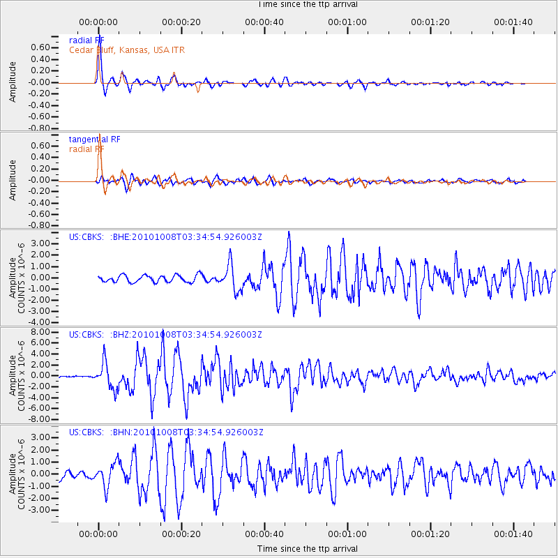
Earthquake location: Andreanof Islands, Aleutian Is.
Earthquake latitude/longitude: 51.4/-175.4
Earthquake time(UTC): 2010/10/08 (281) 03:26:13 GMT
Earthquake Depth: 19 km
Earthquake Magnitude: 6.2 MB, 6.3 MS, 6.4 MW, 6.2 MW
Earthquake Catalog/Contributor: WHDF/NEIC
Network: US United States National Seismic Network
Station: CBKS Cedar Bluff, Kansas, USA
Lat/Lon: 38.81 N/99.74 W
Elevation: 677 m
Distance: 52.6 deg
Az: 72.396 deg
Baz: 310.117 deg
Ray Param: 0.0666618
Estimated Moho Depth: 43.25 km
Estimated Crust Vp/Vs: 1.94
Assumed Crust Vp: 6.483 km/s
Estimated Crust Vs: 3.346 km/s
Estimated Crust Poisson's Ratio: 0.32
Radial Match: 97.03643 %
Radial Bump: 344
Transverse Match: 82.32127 %
Transverse Bump: 400
SOD ConfigId: 339645
Insert Time: 2011-02-10 08:18:19.204 +0000
GWidth: 2.5
Max Bumps: 400
Tol: 0.001

Signal To Noise

ChannelStoNSTALTA
US:CBKS: :BHZ:20101008T03:34:54.926003Z13.2334222.4633607E-61.8614692E-7
US:CBKS: :BHN:20101008T03:34:54.926003Z3.55590139.957872E-72.8003794E-7
US:CBKS: :BHE:20101008T03:34:54.926003Z3.87312081.1929708E-63.080128E-7
Arrivals
Ps6.6 SECOND
PpPs19 SECOND
PsPs/PpSs25 SECOND