ACSO Alum Creek State Park, Ohio, USA - Earthquake Result Viewer
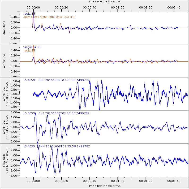
Earthquake location: Andreanof Islands, Aleutian Is.
Earthquake latitude/longitude: 51.4/-175.4
Earthquake time(UTC): 2010/10/08 (281) 03:26:13 GMT
Earthquake Depth: 19 km
Earthquake Magnitude: 6.2 MB, 6.3 MS, 6.4 MW, 6.2 MW
Earthquake Catalog/Contributor: WHDF/NEIC
Network: US United States National Seismic Network
Station: ACSO Alum Creek State Park, Ohio, USA
Lat/Lon: 40.23 N/82.98 W
Elevation: 288 m
Distance: 61.2 deg
Az: 60.771 deg
Baz: 314.4 deg
Ray Param: 0.06099182
Estimated Moho Depth: 48.75 km
Estimated Crust Vp/Vs: 1.77
Assumed Crust Vp: 6.498 km/s
Estimated Crust Vs: 3.676 km/s
Estimated Crust Poisson's Ratio: 0.26
Radial Match: 94.68897 %
Radial Bump: 320
Transverse Match: 78.555595 %
Transverse Bump: 400
SOD ConfigId: 339645
Insert Time: 2011-02-10 08:19:28.290 +0000
GWidth: 2.5
Max Bumps: 400
Tol: 0.001

Signal To Noise

ChannelStoNSTALTA
US:ACSO: :BHZ:20101008T03:35:56.249978Z14.4887053.7413113E-62.5822263E-7
US:ACSO: :BHN:20101008T03:35:56.249978Z6.85279041.636424E-62.3879676E-7
US:ACSO: :BHE:20101008T03:35:56.249978Z3.99002129.611067E-72.4087757E-7
Arrivals
Ps6.0 SECOND
PpPs20 SECOND
PsPs/PpSs26 SECOND