MSO Missoula, Montana, USA - Earthquake Result Viewer
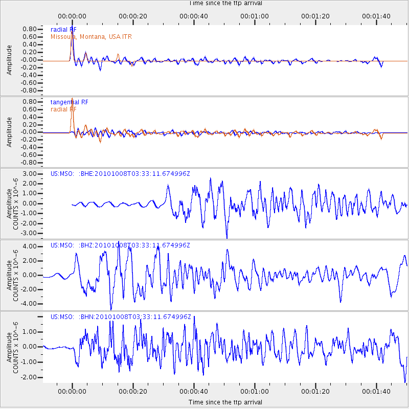
Earthquake location: Andreanof Islands, Aleutian Is.
Earthquake latitude/longitude: 51.4/-175.4
Earthquake time(UTC): 2010/10/08 (281) 03:26:13 GMT
Earthquake Depth: 19 km
Earthquake Magnitude: 6.2 MB, 6.3 MS, 6.4 MW, 6.2 MW
Earthquake Catalog/Contributor: WHDF/NEIC
Network: US United States National Seismic Network
Station: MSO Missoula, Montana, USA
Lat/Lon: 46.83 N/113.94 W
Elevation: 1264 m
Distance: 39.4 deg
Az: 71.67 deg
Baz: 299.939 deg
Ray Param: 0.074964166
Estimated Moho Depth: 25.25 km
Estimated Crust Vp/Vs: 2.08
Assumed Crust Vp: 6.353 km/s
Estimated Crust Vs: 3.051 km/s
Estimated Crust Poisson's Ratio: 0.35
Radial Match: 92.24684 %
Radial Bump: 400
Transverse Match: 82.20252 %
Transverse Bump: 400
SOD ConfigId: 339645
Insert Time: 2011-02-10 08:19:54.992 +0000
GWidth: 2.5
Max Bumps: 400
Tol: 0.001

Signal To Noise

ChannelStoNSTALTA
US:MSO: :BHZ:20101008T03:33:11.674996Z11.3298891.6917811E-61.4932019E-7
US:MSO: :BHN:20101008T03:33:11.674996Z4.5461326.321317E-71.3904824E-7
US:MSO: :BHE:20101008T03:33:11.674996Z6.0366889.5323264E-71.5790657E-7
Arrivals
Ps4.6 SECOND
PpPs12 SECOND
PsPs/PpSs16 SECOND