
MNTX Cornudas Mountains, Texas, USA - Earthquake Result Viewer
| ||||||||||||||||||
| ||||||||||||||||||
| ||||||||||||||||||
|
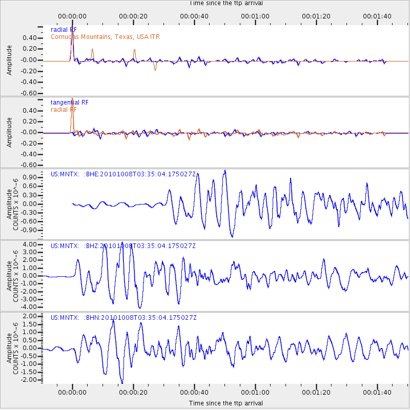
Signal To Noise
| Channel | StoN | STA | LTA |
| US:MNTX: :BHZ:20101008T03:35:04.175027Z | 18.531487 | 1.3186377E-6 | 7.1156606E-8 |
| US:MNTX: :BHN:20101008T03:35:04.175027Z | 7.7533646 | 5.099706E-7 | 6.57741E-8 |
| US:MNTX: :BHE:20101008T03:35:04.175027Z | 6.3684726 | 3.4290193E-7 | 5.3843664E-8 |
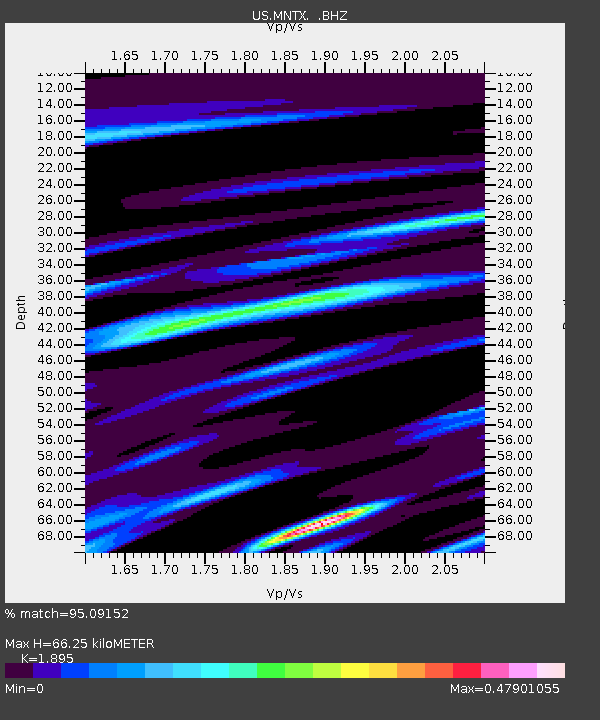
| Arrivals | |
| Ps | 9.8 SECOND |
| PpPs | 29 SECOND |
| PsPs/PpSs | 38 SECOND |

