You are here: Home > Network List > US - United States National Seismic Network Stations List
> Station DGMT Dagmar, Montana, USA > Earthquake Result Viewer
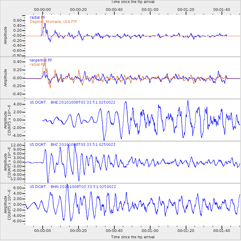
DGMT Dagmar, Montana, USA - Earthquake Result Viewer
*The percent match for this event was below the threshold and hence no stack was calculated.
| Earthquake location: |
Andreanof Islands, Aleutian Is. |
| Earthquake latitude/longitude: |
51.4/-175.4 |
| Earthquake time(UTC): |
2010/10/08 (281) 03:26:13 GMT |
| Earthquake Depth: |
19 km |
| Earthquake Magnitude: |
6.2 MB, 6.3 MS, 6.4 MW, 6.2 MW |
| Earthquake Catalog/Contributor: |
WHDF/NEIC |
|
| Network: |
US United States National Seismic Network |
| Station: |
DGMT Dagmar, Montana, USA |
| Lat/Lon: |
48.47 N/104.20 W |
| Elevation: |
0.0 m |
|
| Distance: |
44.3 deg |
| Az: |
64.5 deg |
| Baz: |
301.779 deg |
| Ray Param: |
$rayparam |
*The percent match for this event was below the threshold and hence was not used in the summary stack. |
|
| Radial Match: |
87.405556 % |
| Radial Bump: |
400 |
| Transverse Match: |
82.86912 % |
| Transverse Bump: |
392 |
| SOD ConfigId: |
339645 |
| Insert Time: |
2011-02-10 08:20:09.024 +0000 |
| GWidth: |
2.5 |
| Max Bumps: |
400 |
| Tol: |
0.001 |
|
Signal To Noise
| Channel | StoN | STA | LTA |
| US:DGMT: :BHZ:20101008T03:33:51.025002Z | 17.116945 | 6.5344407E-6 | 3.8175276E-7 |
| US:DGMT: :BHN:20101008T03:33:51.025002Z | 2.7431452 | 2.2490988E-6 | 8.198978E-7 |
| US:DGMT: :BHE:20101008T03:33:51.025002Z | 3.2169 | 2.4527178E-6 | 7.624476E-7 |
| Arrivals |
| Ps | |
| PpPs | |
| PsPs/PpSs | |


