You are here: Home > Network List > US - United States National Seismic Network Stations List
> Station AMTX Amarillo, Texas, USA > Earthquake Result Viewer
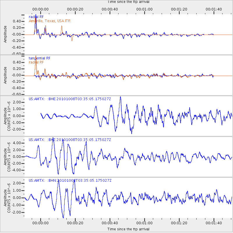
AMTX Amarillo, Texas, USA - Earthquake Result Viewer
*The percent match for this event was below the threshold and hence no stack was calculated.
| Earthquake location: |
Andreanof Islands, Aleutian Is. |
| Earthquake latitude/longitude: |
51.4/-175.4 |
| Earthquake time(UTC): |
2010/10/08 (281) 03:26:13 GMT |
| Earthquake Depth: |
19 km |
| Earthquake Magnitude: |
6.2 MB, 6.3 MS, 6.4 MW, 6.2 MW |
| Earthquake Catalog/Contributor: |
WHDF/NEIC |
|
| Network: |
US United States National Seismic Network |
| Station: |
AMTX Amarillo, Texas, USA |
| Lat/Lon: |
34.53 N/101.41 W |
| Elevation: |
1010 m |
|
| Distance: |
54.4 deg |
| Az: |
77.504 deg |
| Baz: |
312.165 deg |
| Ray Param: |
$rayparam |
*The percent match for this event was below the threshold and hence was not used in the summary stack. |
|
| Radial Match: |
94.07121 % |
| Radial Bump: |
368 |
| Transverse Match: |
75.672134 % |
| Transverse Bump: |
400 |
| SOD ConfigId: |
339645 |
| Insert Time: |
2011-02-10 08:20:22.184 +0000 |
| GWidth: |
2.5 |
| Max Bumps: |
400 |
| Tol: |
0.001 |
|
Signal To Noise
| Channel | StoN | STA | LTA |
| US:AMTX: :BHZ:20101008T03:35:05.175027Z | 7.380612 | 1.8619661E-6 | 2.5227803E-7 |
| US:AMTX: :BHN:20101008T03:35:05.175027Z | 3.5099375 | 6.497854E-7 | 1.8512735E-7 |
| US:AMTX: :BHE:20101008T03:35:05.175027Z | 4.8349595 | 8.7684487E-7 | 1.8135516E-7 |
| Arrivals |
| Ps | |
| PpPs | |
| PsPs/PpSs | |


