
YACT Amboy, WA, USA - Earthquake Result Viewer
| ||||||||||||||||||
| ||||||||||||||||||
| ||||||||||||||||||
|
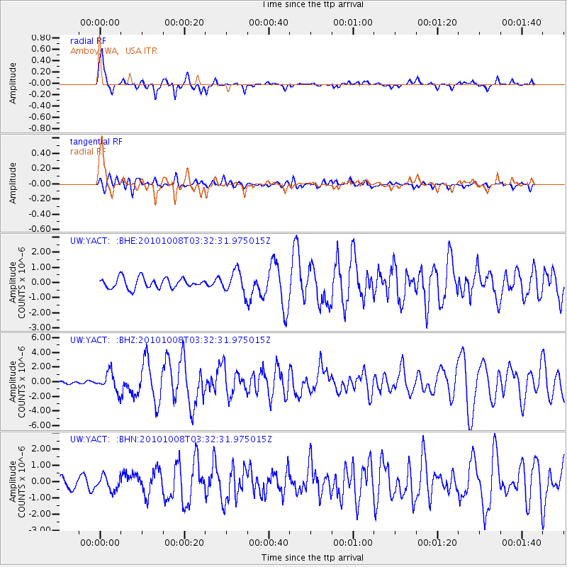
Signal To Noise
| Channel | StoN | STA | LTA |
| UW:YACT: :BHZ:20101008T03:32:31.975015Z | 4.1769247 | 1.2995829E-6 | 3.111339E-7 |
| UW:YACT: :BHN:20101008T03:32:31.975015Z | 1.0944129 | 4.3771115E-7 | 3.9995064E-7 |
| UW:YACT: :BHE:20101008T03:32:31.975015Z | 2.1608484 | 7.3728046E-7 | 3.4119955E-7 |
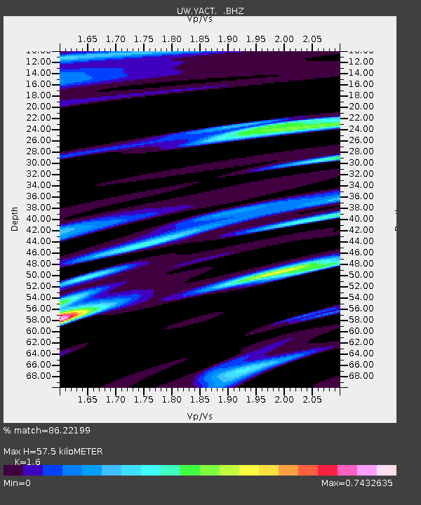
| Arrivals | |
| Ps | 5.7 SECOND |
| PpPs | 21 SECOND |
| PsPs/PpSs | 27 SECOND |

