You are here: Home > Network List > UW - Pacific Northwest Regional Seismic Network Stations List
> Station LCCR Mulino, OR, USA > Earthquake Result Viewer
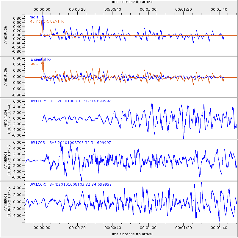
LCCR Mulino, OR, USA - Earthquake Result Viewer
*The percent match for this event was below the threshold and hence no stack was calculated.
| Earthquake location: |
Andreanof Islands, Aleutian Is. |
| Earthquake latitude/longitude: |
51.4/-175.4 |
| Earthquake time(UTC): |
2010/10/08 (281) 03:26:13 GMT |
| Earthquake Depth: |
19 km |
| Earthquake Magnitude: |
6.2 MB, 6.3 MS, 6.4 MW, 6.2 MW |
| Earthquake Catalog/Contributor: |
WHDF/NEIC |
|
| Network: |
UW Pacific Northwest Regional Seismic Network |
| Station: |
LCCR Mulino, OR, USA |
| Lat/Lon: |
45.21 N/122.48 W |
| Elevation: |
273 m |
|
| Distance: |
35.1 deg |
| Az: |
78.869 deg |
| Baz: |
299.547 deg |
| Ray Param: |
$rayparam |
*The percent match for this event was below the threshold and hence was not used in the summary stack. |
|
| Radial Match: |
79.39658 % |
| Radial Bump: |
400 |
| Transverse Match: |
69.93586 % |
| Transverse Bump: |
400 |
| SOD ConfigId: |
339645 |
| Insert Time: |
2011-02-10 08:22:14.342 +0000 |
| GWidth: |
2.5 |
| Max Bumps: |
400 |
| Tol: |
0.001 |
|
Signal To Noise
| Channel | StoN | STA | LTA |
| UW:LCCR: :BHZ:20101008T03:32:34.69999Z | 2.7761211 | 9.913779E-7 | 3.5710903E-7 |
| UW:LCCR: :BHN:20101008T03:32:34.69999Z | 1.6957198 | 8.00479E-7 | 4.7205847E-7 |
| UW:LCCR: :BHE:20101008T03:32:34.69999Z | 1.347413 | 8.1286606E-7 | 6.0327903E-7 |
| Arrivals |
| Ps | |
| PpPs | |
| PsPs/PpSs | |


