You are here: Home > Network List > TA - USArray Transportable Network (new EarthScope stations) Stations List
> Station P31A Stockton, KS, USA > Earthquake Result Viewer
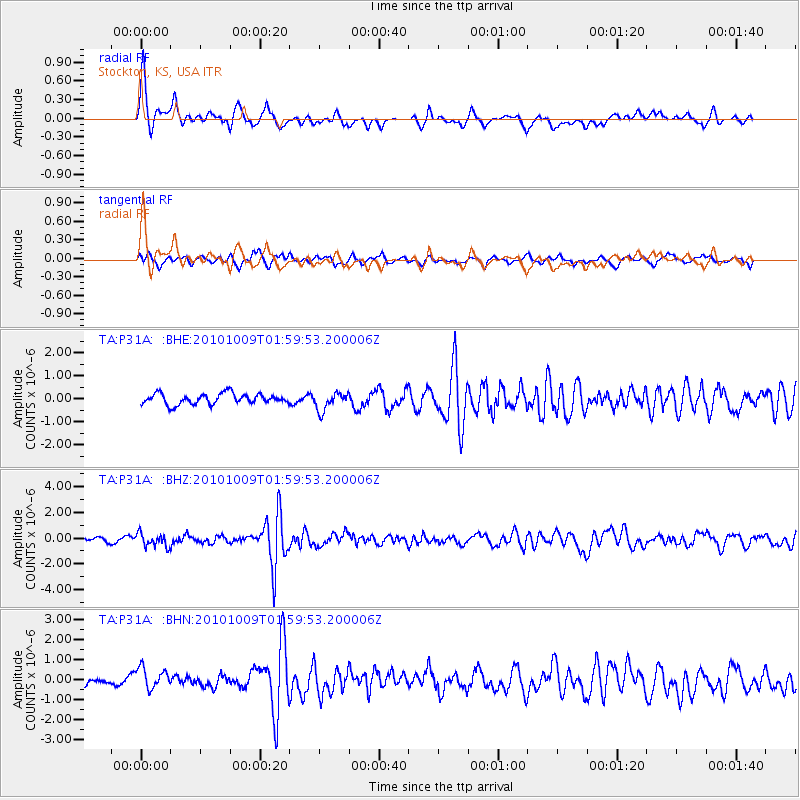
P31A Stockton, KS, USA - Earthquake Result Viewer
*The percent match for this event was below the threshold and hence no stack was calculated.
| Earthquake location: |
Costa Rica |
| Earthquake latitude/longitude: |
10.2/-84.3 |
| Earthquake time(UTC): |
2010/10/09 (282) 01:54:04 GMT |
| Earthquake Depth: |
91 km |
| Earthquake Magnitude: |
5.5 MB, 5.8 MW, 5.8 MW |
| Earthquake Catalog/Contributor: |
WHDF/NEIC |
|
| Network: |
TA USArray Transportable Network (new EarthScope stations) |
| Station: |
P31A Stockton, KS, USA |
| Lat/Lon: |
39.52 N/99.38 W |
| Elevation: |
665 m |
|
| Distance: |
32.1 deg |
| Az: |
337.763 deg |
| Baz: |
151.209 deg |
| Ray Param: |
$rayparam |
*The percent match for this event was below the threshold and hence was not used in the summary stack. |
|
| Radial Match: |
78.44624 % |
| Radial Bump: |
400 |
| Transverse Match: |
60.867924 % |
| Transverse Bump: |
400 |
| SOD ConfigId: |
339645 |
| Insert Time: |
2011-02-10 08:44:14.285 +0000 |
| GWidth: |
2.5 |
| Max Bumps: |
400 |
| Tol: |
0.001 |
|
Signal To Noise
| Channel | StoN | STA | LTA |
| TA:P31A: :BHZ:20101009T01:59:53.200006Z | 3.3680153 | 5.168556E-7 | 1.5346E-7 |
| TA:P31A: :BHN:20101009T01:59:53.200006Z | 1.8059453 | 5.397372E-7 | 2.9886687E-7 |
| TA:P31A: :BHE:20101009T01:59:53.200006Z | 1.7474986 | 3.9866708E-7 | 2.2813585E-7 |
| Arrivals |
| Ps | |
| PpPs | |
| PsPs/PpSs | |


