You are here: Home > Network List > US - United States National Seismic Network Stations List
> Station HAWA Hanford, Washington, USA > Earthquake Result Viewer
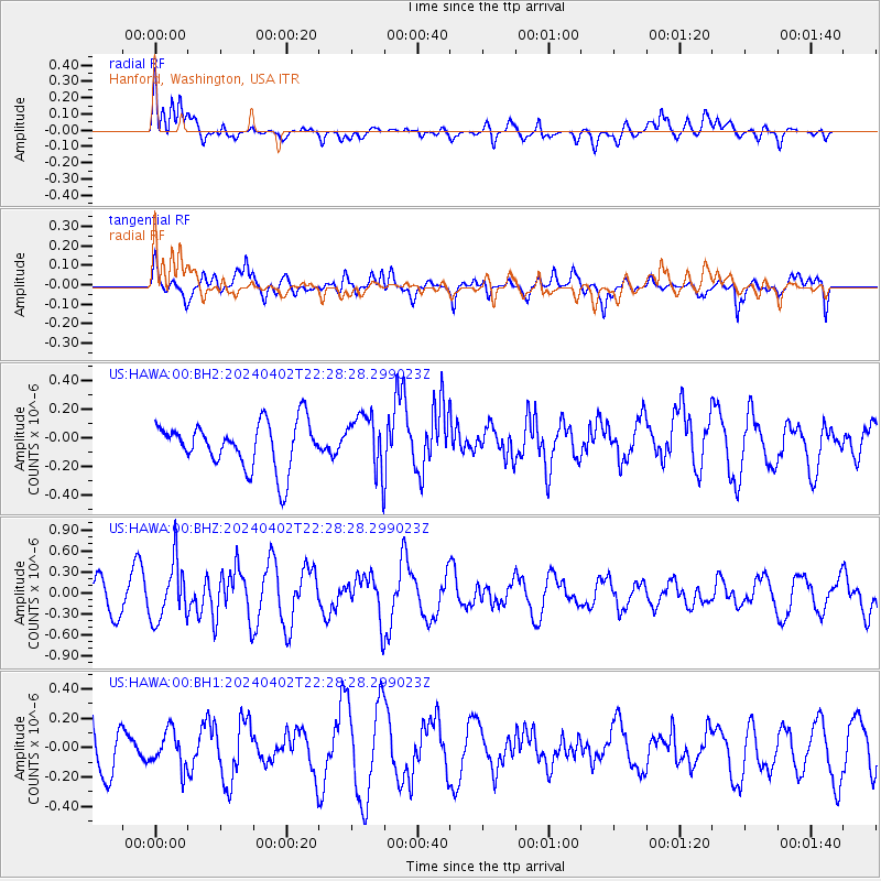
HAWA Hanford, Washington, USA - Earthquake Result Viewer
*The percent match for this event was below the threshold and hence no stack was calculated.
| Earthquake location: |
Mariana Islands |
| Earthquake latitude/longitude: |
15.9/146.9 |
| Earthquake time(UTC): |
2024/04/02 (093) 22:16:44 GMT |
| Earthquake Depth: |
10 km |
| Earthquake Magnitude: |
5.2 Mww |
| Earthquake Catalog/Contributor: |
NEIC PDE/us |
|
| Network: |
US United States National Seismic Network |
| Station: |
HAWA Hanford, Washington, USA |
| Lat/Lon: |
46.39 N/119.53 W |
| Elevation: |
364 m |
|
| Distance: |
81.1 deg |
| Az: |
44.365 deg |
| Baz: |
283.558 deg |
| Ray Param: |
$rayparam |
*The percent match for this event was below the threshold and hence was not used in the summary stack. |
|
| Radial Match: |
40.04079 % |
| Radial Bump: |
400 |
| Transverse Match: |
71.70362 % |
| Transverse Bump: |
400 |
| SOD ConfigId: |
34025071 |
| Insert Time: |
2024-04-16 22:36:42.864 +0000 |
| GWidth: |
2.5 |
| Max Bumps: |
400 |
| Tol: |
0.001 |
|
Signal To Noise
| Channel | StoN | STA | LTA |
| US:HAWA:00:BHZ:20240402T22:28:28.299023Z | 2.2053075 | 4.1419833E-7 | 1.8781886E-7 |
| US:HAWA:00:BH1:20240402T22:28:28.299023Z | 0.58248425 | 1.2345173E-7 | 2.1194003E-7 |
| US:HAWA:00:BH2:20240402T22:28:28.299023Z | 1.1978081 | 1.9280888E-7 | 1.6096809E-7 |
| Arrivals |
| Ps | |
| PpPs | |
| PsPs/PpSs | |


