You are here: Home > Network List > US - United States National Seismic Network Stations List
> Station EGMT Eagleton, Montana, USA > Earthquake Result Viewer
EGMT Eagleton, Montana, USA - Earthquake Result Viewer
*The percent match for this event was below the threshold and hence no stack was calculated.
| Earthquake location: |
Costa Rica |
| Earthquake latitude/longitude: |
10.2/-84.3 |
| Earthquake time(UTC): |
2010/10/09 (282) 01:54:04 GMT |
| Earthquake Depth: |
91 km |
| Earthquake Magnitude: |
5.5 MB, 5.8 MW, 5.8 MW |
| Earthquake Catalog/Contributor: |
WHDF/NEIC |
|
| Network: |
US United States National Seismic Network |
| Station: |
EGMT Eagleton, Montana, USA |
| Lat/Lon: |
48.02 N/109.75 W |
| Elevation: |
1055 m |
|
| Distance: |
43.4 deg |
| Az: |
335.139 deg |
| Baz: |
141.941 deg |
| Ray Param: |
$rayparam |
*The percent match for this event was below the threshold and hence was not used in the summary stack. |
|
| Radial Match: |
36.59785 % |
| Radial Bump: |
400 |
| Transverse Match: |
32.464115 % |
| Transverse Bump: |
400 |
| SOD ConfigId: |
339645 |
| Insert Time: |
2011-02-10 08:56:33.951 +0000 |
| GWidth: |
2.5 |
| Max Bumps: |
400 |
| Tol: |
0.001 |
|
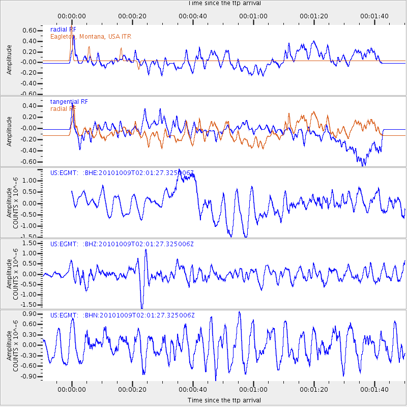
Signal To Noise
| Channel | StoN | STA | LTA |
| US:EGMT: :BHZ:20101009T02:01:27.325006Z | 3.3786461 | 3.926033E-7 | 1.1620137E-7 |
| US:EGMT: :BHN:20101009T02:01:27.325006Z | 1.2650969 | 4.4290482E-7 | 3.5009558E-7 |
| US:EGMT: :BHE:20101009T02:01:27.325006Z | 1.3180418 | 4.8109365E-7 | 3.6500634E-7 |
| Arrivals |
| Ps | |
| PpPs | |
| PsPs/PpSs | |


