You are here: Home > Network List > CI - Caltech Regional Seismic Network Stations List
> Station DGR Domenigoni Reservoir, California, USA > Earthquake Result Viewer
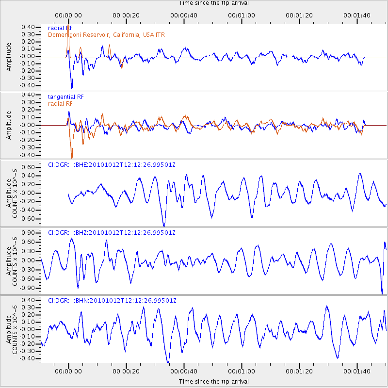
DGR Domenigoni Reservoir, California, USA - Earthquake Result Viewer
*The percent match for this event was below the threshold and hence no stack was calculated.
| Earthquake location: |
Tonga Islands |
| Earthquake latitude/longitude: |
-20.5/-174.2 |
| Earthquake time(UTC): |
2010/10/12 (285) 12:01:07 GMT |
| Earthquake Depth: |
10 km |
| Earthquake Magnitude: |
5.9 MB, 5.8 MS |
| Earthquake Catalog/Contributor: |
WHDF/NEIC |
|
| Network: |
CI Caltech Regional Seismic Network |
| Station: |
DGR Domenigoni Reservoir, California, USA |
| Lat/Lon: |
33.65 N/117.01 W |
| Elevation: |
609 m |
|
| Distance: |
76.6 deg |
| Az: |
46.122 deg |
| Baz: |
234.125 deg |
| Ray Param: |
$rayparam |
*The percent match for this event was below the threshold and hence was not used in the summary stack. |
|
| Radial Match: |
64.50395 % |
| Radial Bump: |
400 |
| Transverse Match: |
56.340717 % |
| Transverse Bump: |
400 |
| SOD ConfigId: |
339645 |
| Insert Time: |
2011-02-10 09:08:42.204 +0000 |
| GWidth: |
2.5 |
| Max Bumps: |
400 |
| Tol: |
0.001 |
|
Signal To Noise
| Channel | StoN | STA | LTA |
| CI:DGR: :BHZ:20101012T12:12:26.99501Z | 2.2270067 | 5.0068604E-7 | 2.2482467E-7 |
| CI:DGR: :BHN:20101012T12:12:26.99501Z | 0.8300335 | 1.05682425E-7 | 1.2732309E-7 |
| CI:DGR: :BHE:20101012T12:12:26.99501Z | 2.8366046 | 3.9803408E-7 | 1.4032061E-7 |
| Arrivals |
| Ps | |
| PpPs | |
| PsPs/PpSs | |


