You are here: Home > Network List > TA - USArray Transportable Network (new EarthScope stations) Stations List
> Station S29A Ulysses, KS, USA > Earthquake Result Viewer
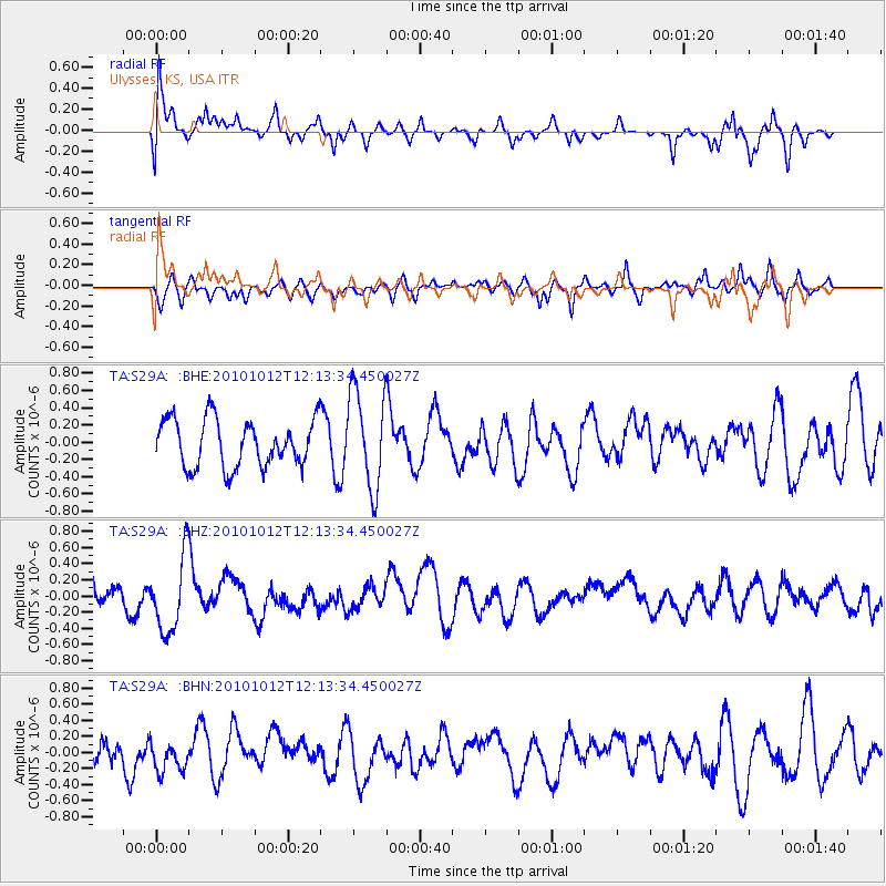
S29A Ulysses, KS, USA - Earthquake Result Viewer
*The percent match for this event was below the threshold and hence no stack was calculated.
| Earthquake location: |
Tonga Islands |
| Earthquake latitude/longitude: |
-20.5/-174.2 |
| Earthquake time(UTC): |
2010/10/12 (285) 12:01:07 GMT |
| Earthquake Depth: |
10 km |
| Earthquake Magnitude: |
5.9 MB, 5.8 MS |
| Earthquake Catalog/Contributor: |
WHDF/NEIC |
|
| Network: |
TA USArray Transportable Network (new EarthScope stations) |
| Station: |
S29A Ulysses, KS, USA |
| Lat/Lon: |
37.62 N/101.12 W |
| Elevation: |
931 m |
|
| Distance: |
89.7 deg |
| Az: |
49.44 deg |
| Baz: |
243.787 deg |
| Ray Param: |
$rayparam |
*The percent match for this event was below the threshold and hence was not used in the summary stack. |
|
| Radial Match: |
70.17647 % |
| Radial Bump: |
390 |
| Transverse Match: |
46.939552 % |
| Transverse Bump: |
400 |
| SOD ConfigId: |
339645 |
| Insert Time: |
2011-02-10 09:12:59.934 +0000 |
| GWidth: |
2.5 |
| Max Bumps: |
400 |
| Tol: |
0.001 |
|
Signal To Noise
| Channel | StoN | STA | LTA |
| TA:S29A: :BHZ:20101012T12:13:34.450027Z | 2.0107746 | 4.6363448E-7 | 2.3057507E-7 |
| TA:S29A: :BHN:20101012T12:13:34.450027Z | 0.97253436 | 1.920091E-7 | 1.9743169E-7 |
| TA:S29A: :BHE:20101012T12:13:34.450027Z | 2.0990827 | 5.7199526E-7 | 2.7249774E-7 |
| Arrivals |
| Ps | |
| PpPs | |
| PsPs/PpSs | |


