You are here: Home > Network List > AK - Alaska Regional Network Stations List
> Station MDM Murphy Dome > Earthquake Result Viewer
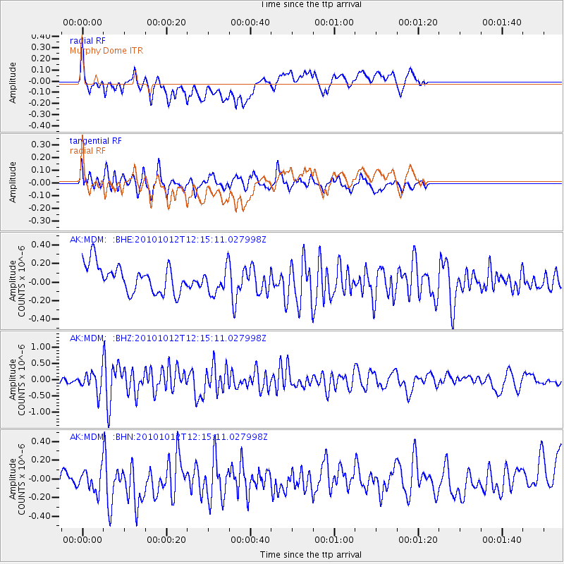
MDM Murphy Dome - Earthquake Result Viewer
*The percent match for this event was below the threshold and hence no stack was calculated.
| Earthquake location: |
Tonga Islands |
| Earthquake latitude/longitude: |
-20.4/-174.1 |
| Earthquake time(UTC): |
2010/10/12 (285) 12:02:55 GMT |
| Earthquake Depth: |
12 km |
| Earthquake Magnitude: |
5.9 MB, 5.8 MS, 5.9 MW, 5.8 MW |
| Earthquake Catalog/Contributor: |
WHDF/NEIC |
|
| Network: |
AK Alaska Regional Network |
| Station: |
MDM Murphy Dome |
| Lat/Lon: |
64.96 N/148.23 W |
| Elevation: |
634 m |
|
| Distance: |
87.4 deg |
| Az: |
10.7 deg |
| Baz: |
204.151 deg |
| Ray Param: |
$rayparam |
*The percent match for this event was below the threshold and hence was not used in the summary stack. |
|
| Radial Match: |
56.21984 % |
| Radial Bump: |
400 |
| Transverse Match: |
60.219883 % |
| Transverse Bump: |
400 |
| SOD ConfigId: |
339645 |
| Insert Time: |
2011-02-10 09:20:07.010 +0000 |
| GWidth: |
2.5 |
| Max Bumps: |
400 |
| Tol: |
0.001 |
|
Signal To Noise
| Channel | StoN | STA | LTA |
| AK:MDM: :BHZ:20101012T12:15:11.027998Z | 2.3614223 | 3.0225476E-7 | 1.2799691E-7 |
| AK:MDM: :BHN:20101012T12:15:11.027998Z | 1.1091257 | 1.8292093E-7 | 1.6492352E-7 |
| AK:MDM: :BHE:20101012T12:15:11.027998Z | 0.9620432 | 1.435152E-7 | 1.491775E-7 |
| Arrivals |
| Ps | |
| PpPs | |
| PsPs/PpSs | |


