You are here: Home > Network List > CI - Caltech Regional Seismic Network Stations List
> Station GLA Glamis, Glamis, CA, USA > Earthquake Result Viewer
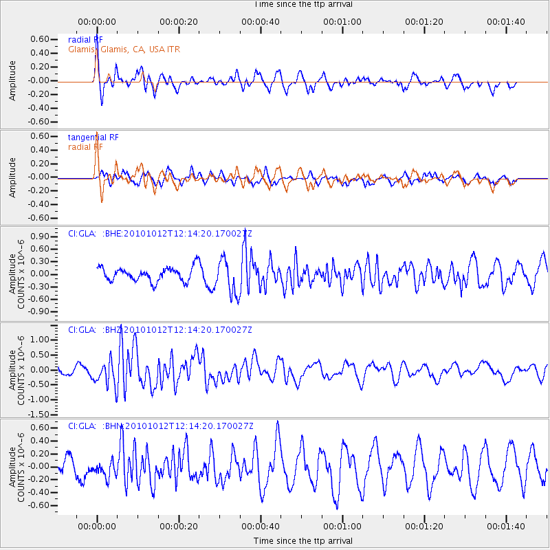
GLA Glamis, Glamis, CA, USA - Earthquake Result Viewer
*The percent match for this event was below the threshold and hence no stack was calculated.
| Earthquake location: |
Tonga Islands |
| Earthquake latitude/longitude: |
-20.4/-174.1 |
| Earthquake time(UTC): |
2010/10/12 (285) 12:02:55 GMT |
| Earthquake Depth: |
12 km |
| Earthquake Magnitude: |
5.9 MB, 5.8 MS, 5.9 MW, 5.8 MW |
| Earthquake Catalog/Contributor: |
WHDF/NEIC |
|
| Network: |
CI Caltech Regional Seismic Network |
| Station: |
GLA Glamis, Glamis, CA, USA |
| Lat/Lon: |
33.05 N/114.83 W |
| Elevation: |
610 m |
|
| Distance: |
77.6 deg |
| Az: |
47.637 deg |
| Baz: |
235.603 deg |
| Ray Param: |
$rayparam |
*The percent match for this event was below the threshold and hence was not used in the summary stack. |
|
| Radial Match: |
54.239754 % |
| Radial Bump: |
400 |
| Transverse Match: |
48.469585 % |
| Transverse Bump: |
400 |
| SOD ConfigId: |
339645 |
| Insert Time: |
2011-02-10 09:23:23.293 +0000 |
| GWidth: |
2.5 |
| Max Bumps: |
400 |
| Tol: |
0.001 |
|
Signal To Noise
| Channel | StoN | STA | LTA |
| CI:GLA: :BHZ:20101012T12:14:20.170027Z | 3.0953653 | 4.1095836E-7 | 1.327657E-7 |
| CI:GLA: :BHN:20101012T12:14:20.170027Z | 0.9348902 | 1.2636751E-7 | 1.3516828E-7 |
| CI:GLA: :BHE:20101012T12:14:20.170027Z | 2.529031 | 4.1704132E-7 | 1.6490164E-7 |
| Arrivals |
| Ps | |
| PpPs | |
| PsPs/PpSs | |


