You are here: Home > Network List > TA - USArray Transportable Network (new EarthScope stations) Stations List
> Station 336A Riesel, TX, USA > Earthquake Result Viewer
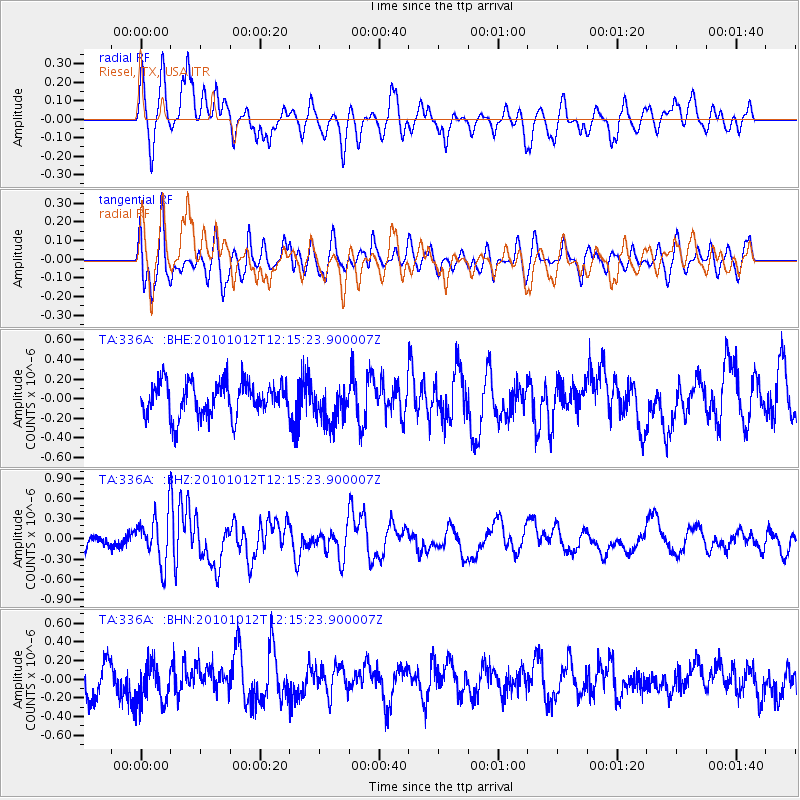
336A Riesel, TX, USA - Earthquake Result Viewer
*The percent match for this event was below the threshold and hence no stack was calculated.
| Earthquake location: |
Tonga Islands |
| Earthquake latitude/longitude: |
-20.4/-174.1 |
| Earthquake time(UTC): |
2010/10/12 (285) 12:02:55 GMT |
| Earthquake Depth: |
12 km |
| Earthquake Magnitude: |
5.9 MB, 5.8 MS, 5.9 MW, 5.8 MW |
| Earthquake Catalog/Contributor: |
WHDF/NEIC |
|
| Network: |
TA USArray Transportable Network (new EarthScope stations) |
| Station: |
336A Riesel, TX, USA |
| Lat/Lon: |
31.39 N/96.84 W |
| Elevation: |
140 m |
|
| Distance: |
90.1 deg |
| Az: |
56.516 deg |
| Baz: |
246.158 deg |
| Ray Param: |
$rayparam |
*The percent match for this event was below the threshold and hence was not used in the summary stack. |
|
| Radial Match: |
65.12054 % |
| Radial Bump: |
400 |
| Transverse Match: |
54.449512 % |
| Transverse Bump: |
400 |
| SOD ConfigId: |
339645 |
| Insert Time: |
2011-02-10 09:31:27.913 +0000 |
| GWidth: |
2.5 |
| Max Bumps: |
400 |
| Tol: |
0.001 |
|
Signal To Noise
| Channel | StoN | STA | LTA |
| TA:336A: :BHZ:20101012T12:15:23.900007Z | 2.3521087 | 3.5465192E-7 | 1.5078041E-7 |
| TA:336A: :BHN:20101012T12:15:23.900007Z | 1.1033528 | 2.1283658E-7 | 1.9289985E-7 |
| TA:336A: :BHE:20101012T12:15:23.900007Z | 1.110006 | 1.9107628E-7 | 1.7213986E-7 |
| Arrivals |
| Ps | |
| PpPs | |
| PsPs/PpSs | |


