You are here: Home > Network List > TA - USArray Transportable Network (new EarthScope stations) Stations List
> Station N23A Red Feather Lakes, CO, USA > Earthquake Result Viewer
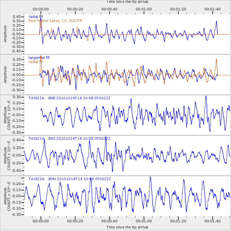
N23A Red Feather Lakes, CO, USA - Earthquake Result Viewer
*The percent match for this event was below the threshold and hence no stack was calculated.
| Earthquake location: |
Hokkaido, Japan Region |
| Earthquake latitude/longitude: |
42.3/142.9 |
| Earthquake time(UTC): |
2010/10/14 (287) 13:58:55 GMT |
| Earthquake Depth: |
59 km |
| Earthquake Magnitude: |
5.6 MW, 5.2 MB |
| Earthquake Catalog/Contributor: |
WHDF/NEIC |
|
| Network: |
TA USArray Transportable Network (new EarthScope stations) |
| Station: |
N23A Red Feather Lakes, CO, USA |
| Lat/Lon: |
40.89 N/105.94 W |
| Elevation: |
2458 m |
|
| Distance: |
76.5 deg |
| Az: |
46.641 deg |
| Baz: |
314.651 deg |
| Ray Param: |
$rayparam |
*The percent match for this event was below the threshold and hence was not used in the summary stack. |
|
| Radial Match: |
54.10512 % |
| Radial Bump: |
400 |
| Transverse Match: |
67.168175 % |
| Transverse Bump: |
400 |
| SOD ConfigId: |
339645 |
| Insert Time: |
2011-02-10 09:42:30.194 +0000 |
| GWidth: |
2.5 |
| Max Bumps: |
400 |
| Tol: |
0.001 |
|
Signal To Noise
| Channel | StoN | STA | LTA |
| TA:N23A: :BHZ:20101014T14:10:08.050022Z | 2.7763114 | 2.053787E-7 | 7.3975386E-8 |
| TA:N23A: :BHN:20101014T14:10:08.050022Z | 1.184111 | 1.2523248E-7 | 1.05760755E-7 |
| TA:N23A: :BHE:20101014T14:10:08.050022Z | 1.306501 | 1.1684554E-7 | 8.943395E-8 |
| Arrivals |
| Ps | |
| PpPs | |
| PsPs/PpSs | |


