You are here: Home > Network List > TA - USArray Transportable Network (new EarthScope stations) Stations List
> Station P31A Stockton, KS, USA > Earthquake Result Viewer
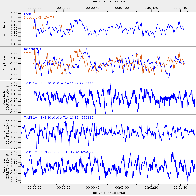
P31A Stockton, KS, USA - Earthquake Result Viewer
*The percent match for this event was below the threshold and hence no stack was calculated.
| Earthquake location: |
Hokkaido, Japan Region |
| Earthquake latitude/longitude: |
42.3/142.9 |
| Earthquake time(UTC): |
2010/10/14 (287) 13:58:55 GMT |
| Earthquake Depth: |
59 km |
| Earthquake Magnitude: |
5.6 MW, 5.2 MB |
| Earthquake Catalog/Contributor: |
WHDF/NEIC |
|
| Network: |
TA USArray Transportable Network (new EarthScope stations) |
| Station: |
P31A Stockton, KS, USA |
| Lat/Lon: |
39.52 N/99.38 W |
| Elevation: |
665 m |
|
| Distance: |
80.9 deg |
| Az: |
43.886 deg |
| Baz: |
318.335 deg |
| Ray Param: |
$rayparam |
*The percent match for this event was below the threshold and hence was not used in the summary stack. |
|
| Radial Match: |
57.099735 % |
| Radial Bump: |
400 |
| Transverse Match: |
60.806656 % |
| Transverse Bump: |
400 |
| SOD ConfigId: |
339645 |
| Insert Time: |
2011-02-10 09:43:29.154 +0000 |
| GWidth: |
2.5 |
| Max Bumps: |
400 |
| Tol: |
0.001 |
|
Signal To Noise
| Channel | StoN | STA | LTA |
| TA:P31A: :BHZ:20101014T14:10:32.425022Z | 2.3583038 | 2.1357545E-7 | 9.0563155E-8 |
| TA:P31A: :BHN:20101014T14:10:32.425022Z | 1.0423708 | 1.4310974E-7 | 1.3729255E-7 |
| TA:P31A: :BHE:20101014T14:10:32.425022Z | 1.473316 | 1.3326363E-7 | 9.04515E-8 |
| Arrivals |
| Ps | |
| PpPs | |
| PsPs/PpSs | |


