You are here: Home > Network List > TA - USArray Transportable Network (new EarthScope stations) Stations List
> Station R36A Gordon, Harris, KS, USA > Earthquake Result Viewer
R36A Gordon, Harris, KS, USA - Earthquake Result Viewer
*The percent match for this event was below the threshold and hence no stack was calculated.
| Earthquake location: |
Hokkaido, Japan Region |
| Earthquake latitude/longitude: |
42.3/142.9 |
| Earthquake time(UTC): |
2010/10/14 (287) 13:58:55 GMT |
| Earthquake Depth: |
59 km |
| Earthquake Magnitude: |
5.6 MW, 5.2 MB |
| Earthquake Catalog/Contributor: |
WHDF/NEIC |
|
| Network: |
TA USArray Transportable Network (new EarthScope stations) |
| Station: |
R36A Gordon, Harris, KS, USA |
| Lat/Lon: |
38.32 N/95.50 W |
| Elevation: |
354 m |
|
| Distance: |
83.8 deg |
| Az: |
42.353 deg |
| Baz: |
320.555 deg |
| Ray Param: |
$rayparam |
*The percent match for this event was below the threshold and hence was not used in the summary stack. |
|
| Radial Match: |
60.080894 % |
| Radial Bump: |
400 |
| Transverse Match: |
37.786186 % |
| Transverse Bump: |
382 |
| SOD ConfigId: |
339645 |
| Insert Time: |
2011-02-10 09:45:50.552 +0000 |
| GWidth: |
2.5 |
| Max Bumps: |
400 |
| Tol: |
0.001 |
|
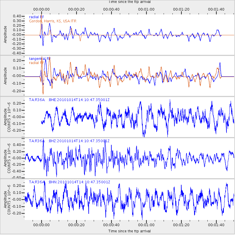
Signal To Noise
| Channel | StoN | STA | LTA |
| TA:R36A: :BHZ:20101014T14:10:47.35001Z | 2.0349746 | 2.3131571E-7 | 1.1367007E-7 |
| TA:R36A: :BHN:20101014T14:10:47.35001Z | 1.6027163 | 1.03587155E-7 | 6.4632246E-8 |
| TA:R36A: :BHE:20101014T14:10:47.35001Z | 1.2945826 | 9.742038E-8 | 7.525235E-8 |
| Arrivals |
| Ps | |
| PpPs | |
| PsPs/PpSs | |


