You are here: Home > Network List > TA - USArray Transportable Network (new EarthScope stations) Stations List
> Station U38A Gravette, AR, USA > Earthquake Result Viewer
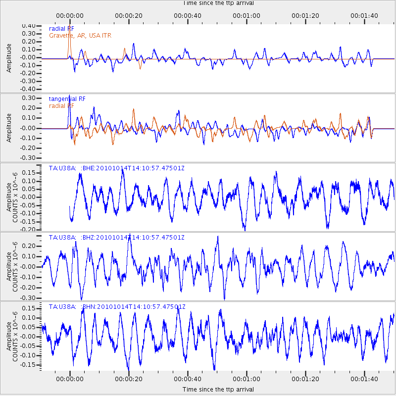
U38A Gravette, AR, USA - Earthquake Result Viewer
*The percent match for this event was below the threshold and hence no stack was calculated.
| Earthquake location: |
Hokkaido, Japan Region |
| Earthquake latitude/longitude: |
42.3/142.9 |
| Earthquake time(UTC): |
2010/10/14 (287) 13:58:55 GMT |
| Earthquake Depth: |
59 km |
| Earthquake Magnitude: |
5.6 MW, 5.2 MB |
| Earthquake Catalog/Contributor: |
WHDF/NEIC |
|
| Network: |
TA USArray Transportable Network (new EarthScope stations) |
| Station: |
U38A Gravette, AR, USA |
| Lat/Lon: |
36.44 N/94.39 W |
| Elevation: |
389 m |
|
| Distance: |
85.8 deg |
| Az: |
42.849 deg |
| Baz: |
321.277 deg |
| Ray Param: |
$rayparam |
*The percent match for this event was below the threshold and hence was not used in the summary stack. |
|
| Radial Match: |
49.007145 % |
| Radial Bump: |
400 |
| Transverse Match: |
51.163425 % |
| Transverse Bump: |
400 |
| SOD ConfigId: |
339645 |
| Insert Time: |
2011-02-10 09:47:01.375 +0000 |
| GWidth: |
2.5 |
| Max Bumps: |
400 |
| Tol: |
0.001 |
|
Signal To Noise
| Channel | StoN | STA | LTA |
| TA:U38A: :BHZ:20101014T14:10:57.47501Z | 1.873737 | 1.7408041E-7 | 9.290547E-8 |
| TA:U38A: :BHN:20101014T14:10:57.47501Z | 1.0711989 | 8.016511E-8 | 7.483681E-8 |
| TA:U38A: :BHE:20101014T14:10:57.47501Z | 1.0438948 | 7.5513455E-8 | 7.233819E-8 |
| Arrivals |
| Ps | |
| PpPs | |
| PsPs/PpSs | |


