You are here: Home > Network List > TA - USArray Transportable Network (new EarthScope stations) Stations List
> Station J34A George, IA, USA > Earthquake Result Viewer
J34A George, IA, USA - Earthquake Result Viewer
*The percent match for this event was below the threshold and hence no stack was calculated.
| Earthquake location: |
Hokkaido, Japan Region |
| Earthquake latitude/longitude: |
42.3/142.9 |
| Earthquake time(UTC): |
2010/10/14 (287) 13:58:55 GMT |
| Earthquake Depth: |
59 km |
| Earthquake Magnitude: |
5.6 MW, 5.2 MB |
| Earthquake Catalog/Contributor: |
WHDF/NEIC |
|
| Network: |
TA USArray Transportable Network (new EarthScope stations) |
| Station: |
J34A George, IA, USA |
| Lat/Lon: |
43.28 N/95.96 W |
| Elevation: |
432 m |
|
| Distance: |
79.8 deg |
| Az: |
39.416 deg |
| Baz: |
319.839 deg |
| Ray Param: |
$rayparam |
*The percent match for this event was below the threshold and hence was not used in the summary stack. |
|
| Radial Match: |
33.17606 % |
| Radial Bump: |
400 |
| Transverse Match: |
29.043774 % |
| Transverse Bump: |
400 |
| SOD ConfigId: |
339645 |
| Insert Time: |
2011-02-10 09:47:30.859 +0000 |
| GWidth: |
2.5 |
| Max Bumps: |
400 |
| Tol: |
0.001 |
|
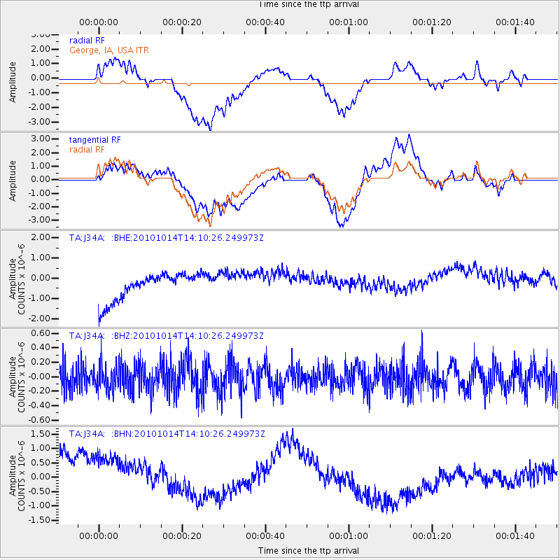
Signal To Noise
| Channel | StoN | STA | LTA |
| TA:J34A: :BHZ:20101014T14:10:26.249973Z | 0.9568278 | 1.77091E-7 | 1.8508136E-7 |
| TA:J34A: :BHN:20101014T14:10:26.249973Z | 0.8803834 | 1.9089214E-6 | 2.168284E-6 |
| TA:J34A: :BHE:20101014T14:10:26.249973Z | 0.97023314 | 6.3312797E-7 | 6.5255244E-7 |
| Arrivals |
| Ps | |
| PpPs | |
| PsPs/PpSs | |


