You are here: Home > Network List > TA - USArray Transportable Network (new EarthScope stations) Stations List
> Station E31A Nome, ND, USA > Earthquake Result Viewer
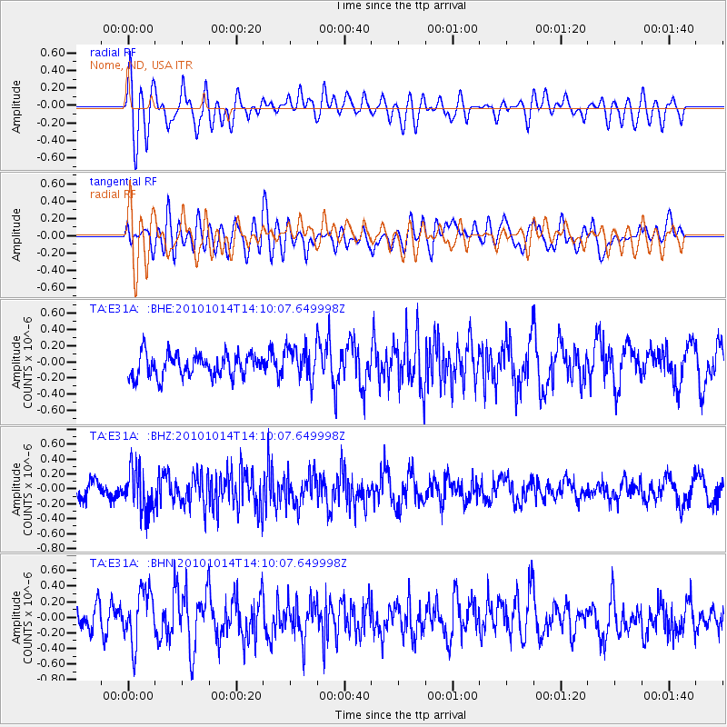
E31A Nome, ND, USA - Earthquake Result Viewer
*The percent match for this event was below the threshold and hence no stack was calculated.
| Earthquake location: |
Hokkaido, Japan Region |
| Earthquake latitude/longitude: |
42.3/142.9 |
| Earthquake time(UTC): |
2010/10/14 (287) 13:58:55 GMT |
| Earthquake Depth: |
59 km |
| Earthquake Magnitude: |
5.6 MW, 5.2 MB |
| Earthquake Catalog/Contributor: |
WHDF/NEIC |
|
| Network: |
TA USArray Transportable Network (new EarthScope stations) |
| Station: |
E31A Nome, ND, USA |
| Lat/Lon: |
46.56 N/97.89 W |
| Elevation: |
427 m |
|
| Distance: |
76.4 deg |
| Az: |
38.281 deg |
| Baz: |
318.246 deg |
| Ray Param: |
$rayparam |
*The percent match for this event was below the threshold and hence was not used in the summary stack. |
|
| Radial Match: |
59.831127 % |
| Radial Bump: |
400 |
| Transverse Match: |
48.99861 % |
| Transverse Bump: |
400 |
| SOD ConfigId: |
339645 |
| Insert Time: |
2011-02-10 09:47:45.477 +0000 |
| GWidth: |
2.5 |
| Max Bumps: |
400 |
| Tol: |
0.001 |
|
Signal To Noise
| Channel | StoN | STA | LTA |
| TA:E31A: :BHZ:20101014T14:10:07.649998Z | 3.1141293 | 2.883651E-7 | 9.259895E-8 |
| TA:E31A: :BHN:20101014T14:10:07.649998Z | 1.8125484 | 3.4404718E-7 | 1.8981407E-7 |
| TA:E31A: :BHE:20101014T14:10:07.649998Z | 1.4758974 | 2.0772046E-7 | 1.407418E-7 |
| Arrivals |
| Ps | |
| PpPs | |
| PsPs/PpSs | |


