You are here: Home > Network List > US - United States National Seismic Network Stations List
> Station ERPA Erie, Pennsylvania, USA > Earthquake Result Viewer
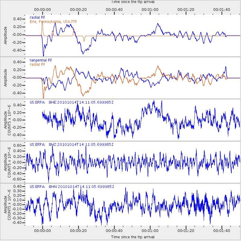
ERPA Erie, Pennsylvania, USA - Earthquake Result Viewer
*The percent match for this event was below the threshold and hence no stack was calculated.
| Earthquake location: |
Hokkaido, Japan Region |
| Earthquake latitude/longitude: |
42.3/142.9 |
| Earthquake time(UTC): |
2010/10/14 (287) 13:58:55 GMT |
| Earthquake Depth: |
59 km |
| Earthquake Magnitude: |
5.6 MW, 5.2 MB |
| Earthquake Catalog/Contributor: |
WHDF/NEIC |
|
| Network: |
US United States National Seismic Network |
| Station: |
ERPA Erie, Pennsylvania, USA |
| Lat/Lon: |
42.12 N/79.99 W |
| Elevation: |
306 m |
|
| Distance: |
87.5 deg |
| Az: |
30.435 deg |
| Baz: |
329.667 deg |
| Ray Param: |
$rayparam |
*The percent match for this event was below the threshold and hence was not used in the summary stack. |
|
| Radial Match: |
42.526417 % |
| Radial Bump: |
400 |
| Transverse Match: |
37.884007 % |
| Transverse Bump: |
400 |
| SOD ConfigId: |
339645 |
| Insert Time: |
2011-02-10 09:49:17.589 +0000 |
| GWidth: |
2.5 |
| Max Bumps: |
400 |
| Tol: |
0.001 |
|
Signal To Noise
| Channel | StoN | STA | LTA |
| US:ERPA: :BHZ:20101014T14:11:05.699985Z | 1.4301578 | 2.7113893E-7 | 1.8958671E-7 |
| US:ERPA: :BHN:20101014T14:11:05.699985Z | 1.8209776 | 2.377956E-7 | 1.3058678E-7 |
| US:ERPA: :BHE:20101014T14:11:05.699985Z | 1.4763734 | 2.0031965E-7 | 1.3568358E-7 |
| Arrivals |
| Ps | |
| PpPs | |
| PsPs/PpSs | |


