You are here: Home > Network List > CI - Caltech Regional Seismic Network Stations List
> Station DAN Danby, California, USA > Earthquake Result Viewer
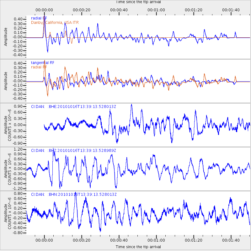
DAN Danby, California, USA - Earthquake Result Viewer
*The percent match for this event was below the threshold and hence no stack was calculated.
| Earthquake location: |
Tonga Islands |
| Earthquake latitude/longitude: |
-20.5/-173.9 |
| Earthquake time(UTC): |
2010/10/16 (289) 13:27:45 GMT |
| Earthquake Depth: |
7.4 km |
| Earthquake Magnitude: |
5.7 MB, 5.7 MS, 5.6 MW, 5.6 MW |
| Earthquake Catalog/Contributor: |
WHDF/NEIC |
|
| Network: |
CI Caltech Regional Seismic Network |
| Station: |
DAN Danby, California, USA |
| Lat/Lon: |
34.64 N/115.38 W |
| Elevation: |
398 m |
|
| Distance: |
78.1 deg |
| Az: |
45.961 deg |
| Baz: |
234.836 deg |
| Ray Param: |
$rayparam |
*The percent match for this event was below the threshold and hence was not used in the summary stack. |
|
| Radial Match: |
74.80797 % |
| Radial Bump: |
400 |
| Transverse Match: |
66.254745 % |
| Transverse Bump: |
391 |
| SOD ConfigId: |
339645 |
| Insert Time: |
2011-02-17 07:39:50.519 +0000 |
| GWidth: |
2.5 |
| Max Bumps: |
400 |
| Tol: |
0.001 |
|
Signal To Noise
| Channel | StoN | STA | LTA |
| CI:DAN: :BHZ:20101016T13:39:13.528989Z | 2.9908707 | 4.7102085E-7 | 1.574862E-7 |
| CI:DAN: :BHN:20101016T13:39:13.528013Z | 0.43482074 | 8.5258584E-8 | 1.9607755E-7 |
| CI:DAN: :BHE:20101016T13:39:13.528013Z | 2.2703667 | 3.2516698E-7 | 1.4322222E-7 |
| Arrivals |
| Ps | |
| PpPs | |
| PsPs/PpSs | |


