You are here: Home > Network List > CI - Caltech Regional Seismic Network Stations List
> Station SLA SLA, Trona, CA, USA > Earthquake Result Viewer
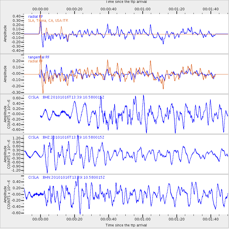
SLA SLA, Trona, CA, USA - Earthquake Result Viewer
*The percent match for this event was below the threshold and hence no stack was calculated.
| Earthquake location: |
Tonga Islands |
| Earthquake latitude/longitude: |
-20.5/-173.9 |
| Earthquake time(UTC): |
2010/10/16 (289) 13:27:45 GMT |
| Earthquake Depth: |
7.4 km |
| Earthquake Magnitude: |
5.7 MB, 5.7 MS, 5.6 MW, 5.6 MW |
| Earthquake Catalog/Contributor: |
WHDF/NEIC |
|
| Network: |
CI Caltech Regional Seismic Network |
| Station: |
SLA SLA, Trona, CA, USA |
| Lat/Lon: |
35.89 N/117.28 W |
| Elevation: |
1174 m |
|
| Distance: |
77.5 deg |
| Az: |
43.99 deg |
| Baz: |
233.325 deg |
| Ray Param: |
$rayparam |
*The percent match for this event was below the threshold and hence was not used in the summary stack. |
|
| Radial Match: |
64.87427 % |
| Radial Bump: |
400 |
| Transverse Match: |
61.709686 % |
| Transverse Bump: |
400 |
| SOD ConfigId: |
339645 |
| Insert Time: |
2011-02-17 07:39:54.078 +0000 |
| GWidth: |
2.5 |
| Max Bumps: |
400 |
| Tol: |
0.001 |
|
Signal To Noise
| Channel | StoN | STA | LTA |
| CI:SLA: :BHZ:20101016T13:39:10.580015Z | 4.103454 | 5.426207E-7 | 1.3223512E-7 |
| CI:SLA: :BHN:20101016T13:39:10.580015Z | 1.3878539 | 1.359498E-7 | 9.795686E-8 |
| CI:SLA: :BHE:20101016T13:39:10.580015Z | 1.6329117 | 2.624334E-7 | 1.60715E-7 |
| Arrivals |
| Ps | |
| PpPs | |
| PsPs/PpSs | |


