You are here: Home > Network List > CI - Caltech Regional Seismic Network Stations List
> Station SMM Simmler, CA, USA > Earthquake Result Viewer
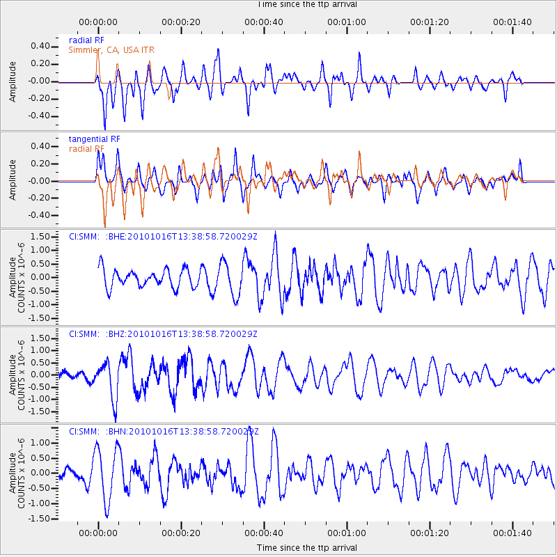
SMM Simmler, CA, USA - Earthquake Result Viewer
*The percent match for this event was below the threshold and hence no stack was calculated.
| Earthquake location: |
Tonga Islands |
| Earthquake latitude/longitude: |
-20.5/-173.9 |
| Earthquake time(UTC): |
2010/10/16 (289) 13:27:45 GMT |
| Earthquake Depth: |
7.4 km |
| Earthquake Magnitude: |
5.7 MB, 5.7 MS, 5.6 MW, 5.6 MW |
| Earthquake Catalog/Contributor: |
WHDF/NEIC |
|
| Network: |
CI Caltech Regional Seismic Network |
| Station: |
SMM Simmler, CA, USA |
| Lat/Lon: |
35.31 N/120.00 W |
| Elevation: |
599 m |
|
| Distance: |
75.4 deg |
| Az: |
43.073 deg |
| Baz: |
231.539 deg |
| Ray Param: |
$rayparam |
*The percent match for this event was below the threshold and hence was not used in the summary stack. |
|
| Radial Match: |
68.1459 % |
| Radial Bump: |
400 |
| Transverse Match: |
58.234215 % |
| Transverse Bump: |
400 |
| SOD ConfigId: |
339645 |
| Insert Time: |
2011-02-17 07:40:09.329 +0000 |
| GWidth: |
2.5 |
| Max Bumps: |
400 |
| Tol: |
0.001 |
|
Signal To Noise
| Channel | StoN | STA | LTA |
| CI:SMM: :BHZ:20101016T13:38:58.720029Z | 2.7881625 | 7.682892E-7 | 2.7555396E-7 |
| CI:SMM: :BHN:20101016T13:38:58.720029Z | 3.1078832 | 8.9144226E-7 | 2.868326E-7 |
| CI:SMM: :BHE:20101016T13:38:58.720029Z | 1.9036053 | 6.144631E-7 | 3.227891E-7 |
| Arrivals |
| Ps | |
| PpPs | |
| PsPs/PpSs | |


