You are here: Home > Network List > TA - USArray Transportable Network (new EarthScope stations) Stations List
> Station M53A WI Miller and Sons, Farmdale, OH, USA > Earthquake Result Viewer
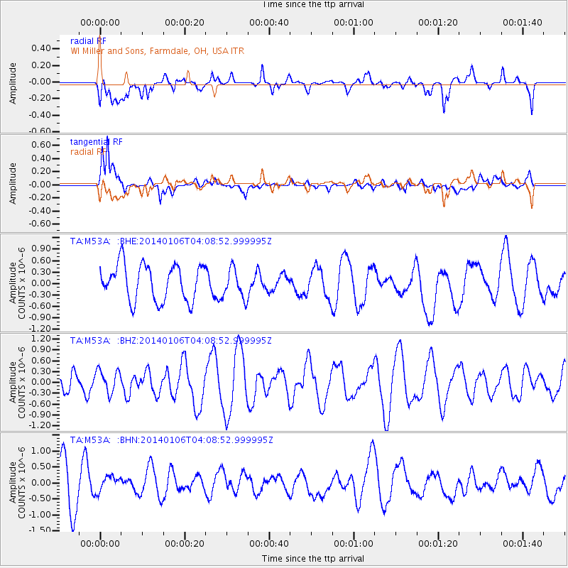
M53A WI Miller and Sons, Farmdale, OH, USA - Earthquake Result Viewer
*The percent match for this event was below the threshold and hence no stack was calculated.
| Earthquake location: |
Near Coast Of Northern Chile |
| Earthquake latitude/longitude: |
-20.7/-70.6 |
| Earthquake time(UTC): |
2014/01/06 (006) 03:59:02 GMT |
| Earthquake Depth: |
27 km |
| Earthquake Magnitude: |
5.2 MW |
| Earthquake Catalog/Contributor: |
ISC/ISC |
|
| Network: |
TA USArray Transportable Network (new EarthScope stations) |
| Station: |
M53A WI Miller and Sons, Farmdale, OH, USA |
| Lat/Lon: |
41.44 N/80.68 W |
| Elevation: |
334 m |
|
| Distance: |
62.5 deg |
| Az: |
351.507 deg |
| Baz: |
169.404 deg |
| Ray Param: |
$rayparam |
*The percent match for this event was below the threshold and hence was not used in the summary stack. |
|
| Radial Match: |
47.492073 % |
| Radial Bump: |
400 |
| Transverse Match: |
61.05245 % |
| Transverse Bump: |
400 |
| SOD ConfigId: |
3390531 |
| Insert Time: |
2019-04-09 21:43:51.819 +0000 |
| GWidth: |
2.5 |
| Max Bumps: |
400 |
| Tol: |
0.001 |
|
Signal To Noise
| Channel | StoN | STA | LTA |
| TA:M53A: :BHZ:20140106T04:08:52.999995Z | 0.98648256 | 3.2283972E-7 | 3.272635E-7 |
| TA:M53A: :BHN:20140106T04:08:52.999995Z | 0.5559602 | 3.32136E-7 | 5.9740967E-7 |
| TA:M53A: :BHE:20140106T04:08:52.999995Z | 0.81671745 | 3.8567632E-7 | 4.7222736E-7 |
| Arrivals |
| Ps | |
| PpPs | |
| PsPs/PpSs | |


