You are here: Home > Network List > US - United States National Seismic Network Stations List
> Station AMTX Amarillo, Texas, USA > Earthquake Result Viewer
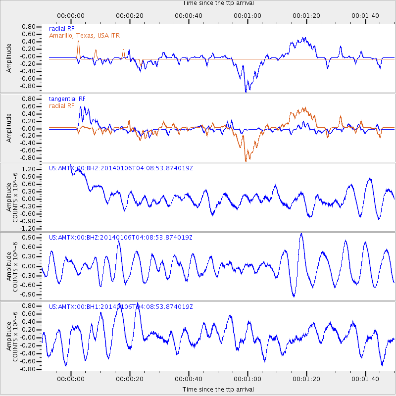
AMTX Amarillo, Texas, USA - Earthquake Result Viewer
*The percent match for this event was below the threshold and hence no stack was calculated.
| Earthquake location: |
Near Coast Of Northern Chile |
| Earthquake latitude/longitude: |
-20.7/-70.6 |
| Earthquake time(UTC): |
2014/01/06 (006) 03:59:02 GMT |
| Earthquake Depth: |
27 km |
| Earthquake Magnitude: |
5.2 MW |
| Earthquake Catalog/Contributor: |
ISC/ISC |
|
| Network: |
US United States National Seismic Network |
| Station: |
AMTX Amarillo, Texas, USA |
| Lat/Lon: |
34.53 N/101.41 W |
| Elevation: |
1010 m |
|
| Distance: |
62.3 deg |
| Az: |
331.493 deg |
| Baz: |
147.237 deg |
| Ray Param: |
$rayparam |
*The percent match for this event was below the threshold and hence was not used in the summary stack. |
|
| Radial Match: |
20.089075 % |
| Radial Bump: |
400 |
| Transverse Match: |
63.20466 % |
| Transverse Bump: |
400 |
| SOD ConfigId: |
3390531 |
| Insert Time: |
2019-04-09 21:44:53.460 +0000 |
| GWidth: |
2.5 |
| Max Bumps: |
400 |
| Tol: |
0.001 |
|
Signal To Noise
| Channel | StoN | STA | LTA |
| US:AMTX:00:BHZ:20140106T04:08:53.874019Z | 0.4830283 | 1.492682E-7 | 3.090258E-7 |
| US:AMTX:00:BH1:20140106T04:08:53.874019Z | 1.4933623 | 9.1424465E-7 | 6.122055E-7 |
| US:AMTX:00:BH2:20140106T04:08:53.874019Z | 1.1903459 | 5.324729E-7 | 4.473262E-7 |
| Arrivals |
| Ps | |
| PpPs | |
| PsPs/PpSs | |


