You are here: Home > Network List > TA - USArray Transportable Network (new EarthScope stations) Stations List
> Station V28A Channing, TX, USA > Earthquake Result Viewer
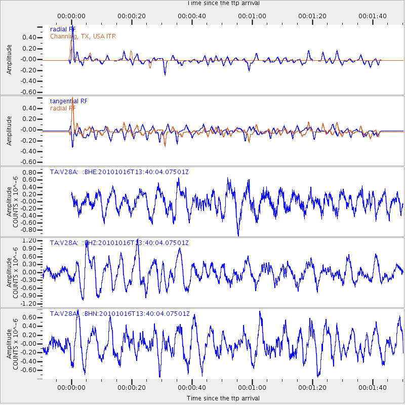
V28A Channing, TX, USA - Earthquake Result Viewer
*The percent match for this event was below the threshold and hence no stack was calculated.
| Earthquake location: |
Tonga Islands |
| Earthquake latitude/longitude: |
-20.5/-173.9 |
| Earthquake time(UTC): |
2010/10/16 (289) 13:27:45 GMT |
| Earthquake Depth: |
7.4 km |
| Earthquake Magnitude: |
5.7 MB, 5.7 MS, 5.6 MW, 5.6 MW |
| Earthquake Catalog/Contributor: |
WHDF/NEIC |
|
| Network: |
TA USArray Transportable Network (new EarthScope stations) |
| Station: |
V28A Channing, TX, USA |
| Lat/Lon: |
35.75 N/102.22 W |
| Elevation: |
1163 m |
|
| Distance: |
87.9 deg |
| Az: |
50.605 deg |
| Baz: |
242.979 deg |
| Ray Param: |
$rayparam |
*The percent match for this event was below the threshold and hence was not used in the summary stack. |
|
| Radial Match: |
66.22361 % |
| Radial Bump: |
400 |
| Transverse Match: |
55.47745 % |
| Transverse Bump: |
400 |
| SOD ConfigId: |
339645 |
| Insert Time: |
2011-02-17 07:46:33.329 +0000 |
| GWidth: |
2.5 |
| Max Bumps: |
400 |
| Tol: |
0.001 |
|
Signal To Noise
| Channel | StoN | STA | LTA |
| TA:V28A: :BHZ:20101016T13:40:04.07501Z | 2.7849596 | 4.869787E-7 | 1.7486025E-7 |
| TA:V28A: :BHN:20101016T13:40:04.07501Z | 2.4764028 | 4.38614E-7 | 1.7711739E-7 |
| TA:V28A: :BHE:20101016T13:40:04.07501Z | 1.3743808 | 2.8912055E-7 | 2.1036422E-7 |
| Arrivals |
| Ps | |
| PpPs | |
| PsPs/PpSs | |


