You are here: Home > Network List > TA - USArray Transportable Network (new EarthScope stations) Stations List
> Station 430A Baggett Ranch, Ozona, TX, USA > Earthquake Result Viewer
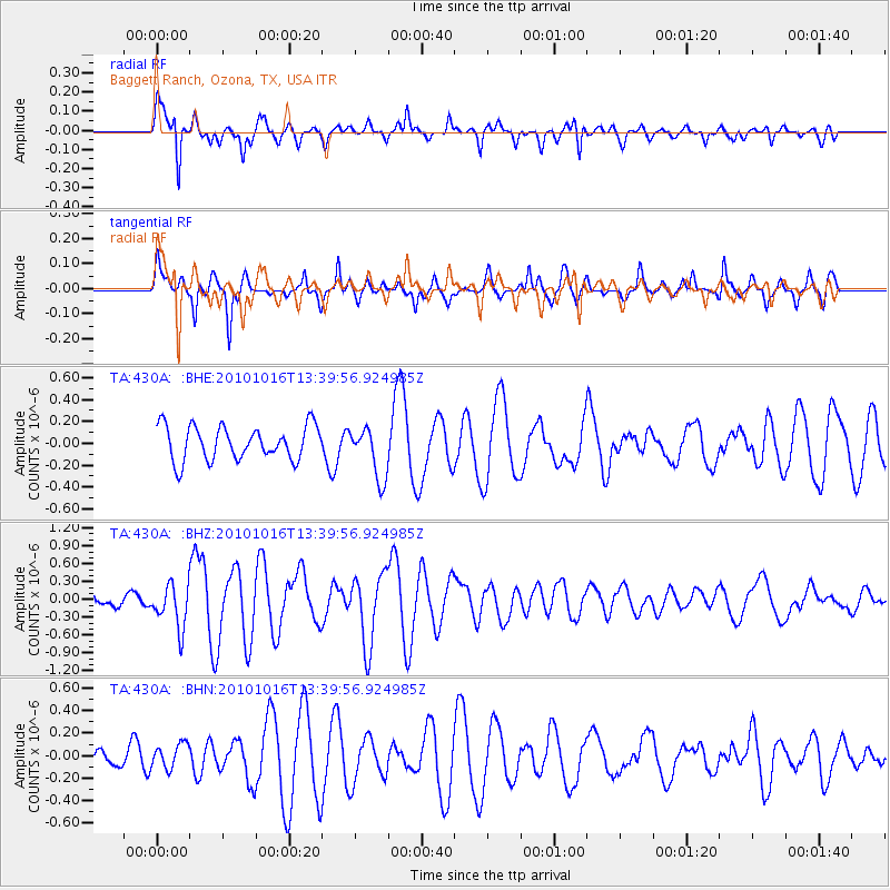
430A Baggett Ranch, Ozona, TX, USA - Earthquake Result Viewer
*The percent match for this event was below the threshold and hence no stack was calculated.
| Earthquake location: |
Tonga Islands |
| Earthquake latitude/longitude: |
-20.5/-173.9 |
| Earthquake time(UTC): |
2010/10/16 (289) 13:27:45 GMT |
| Earthquake Depth: |
7.4 km |
| Earthquake Magnitude: |
5.7 MB, 5.7 MS, 5.6 MW, 5.6 MW |
| Earthquake Catalog/Contributor: |
WHDF/NEIC |
|
| Network: |
TA USArray Transportable Network (new EarthScope stations) |
| Station: |
430A Baggett Ranch, Ozona, TX, USA |
| Lat/Lon: |
30.79 N/101.24 W |
| Elevation: |
768 m |
|
| Distance: |
86.4 deg |
| Az: |
55.408 deg |
| Baz: |
243.761 deg |
| Ray Param: |
$rayparam |
*The percent match for this event was below the threshold and hence was not used in the summary stack. |
|
| Radial Match: |
85.21914 % |
| Radial Bump: |
330 |
| Transverse Match: |
69.603264 % |
| Transverse Bump: |
311 |
| SOD ConfigId: |
339645 |
| Insert Time: |
2011-02-17 07:48:08.377 +0000 |
| GWidth: |
2.5 |
| Max Bumps: |
400 |
| Tol: |
0.001 |
|
Signal To Noise
| Channel | StoN | STA | LTA |
| TA:430A: :BHZ:20101016T13:39:56.924985Z | 2.9851322 | 3.6333753E-7 | 1.2171573E-7 |
| TA:430A: :BHN:20101016T13:39:56.924985Z | 0.7024693 | 1.0798024E-7 | 1.5371525E-7 |
| TA:430A: :BHE:20101016T13:39:56.924985Z | 1.5281174 | 2.3695414E-7 | 1.5506278E-7 |
| Arrivals |
| Ps | |
| PpPs | |
| PsPs/PpSs | |


