You are here: Home > Network List > TA - USArray Transportable Network (new EarthScope stations) Stations List
> Station H26A Fairpoint, SD, USA > Earthquake Result Viewer
H26A Fairpoint, SD, USA - Earthquake Result Viewer
*The percent match for this event was below the threshold and hence no stack was calculated.
| Earthquake location: |
Tonga Islands |
| Earthquake latitude/longitude: |
-20.5/-173.9 |
| Earthquake time(UTC): |
2010/10/16 (289) 13:27:45 GMT |
| Earthquake Depth: |
7.4 km |
| Earthquake Magnitude: |
5.7 MB, 5.7 MS, 5.6 MW, 5.6 MW |
| Earthquake Catalog/Contributor: |
WHDF/NEIC |
|
| Network: |
TA USArray Transportable Network (new EarthScope stations) |
| Station: |
H26A Fairpoint, SD, USA |
| Lat/Lon: |
44.62 N/102.77 W |
| Elevation: |
879 m |
|
| Distance: |
91.5 deg |
| Az: |
42.538 deg |
| Baz: |
242.582 deg |
| Ray Param: |
$rayparam |
*The percent match for this event was below the threshold and hence was not used in the summary stack. |
|
| Radial Match: |
64.994576 % |
| Radial Bump: |
294 |
| Transverse Match: |
53.44323 % |
| Transverse Bump: |
337 |
| SOD ConfigId: |
339645 |
| Insert Time: |
2011-02-17 07:50:36.824 +0000 |
| GWidth: |
2.5 |
| Max Bumps: |
400 |
| Tol: |
0.001 |
|
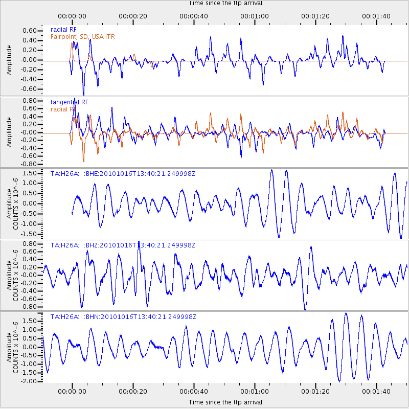
Signal To Noise
| Channel | StoN | STA | LTA |
| TA:H26A: :BHZ:20101016T13:40:21.249998Z | 2.2345088 | 3.8937537E-7 | 1.7425548E-7 |
| TA:H26A: :BHN:20101016T13:40:21.249998Z | 0.5635227 | 3.8411733E-7 | 6.81636E-7 |
| TA:H26A: :BHE:20101016T13:40:21.249998Z | 0.6552911 | 3.1940587E-7 | 4.8742595E-7 |
| Arrivals |
| Ps | |
| PpPs | |
| PsPs/PpSs | |


