You are here: Home > Network List > TA - USArray Transportable Network (new EarthScope stations) Stations List
> Station B27A Peters Farms, Glenburn, ND, USA > Earthquake Result Viewer
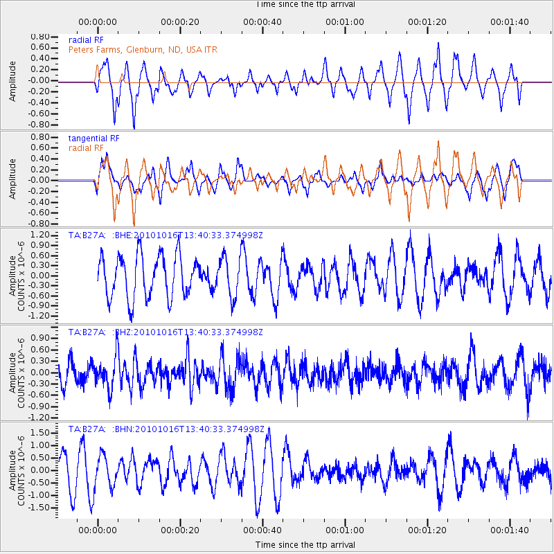
B27A Peters Farms, Glenburn, ND, USA - Earthquake Result Viewer
*The percent match for this event was below the threshold and hence no stack was calculated.
| Earthquake location: |
Tonga Islands |
| Earthquake latitude/longitude: |
-20.5/-173.9 |
| Earthquake time(UTC): |
2010/10/16 (289) 13:27:45 GMT |
| Earthquake Depth: |
7.4 km |
| Earthquake Magnitude: |
5.7 MB, 5.7 MS, 5.6 MW, 5.6 MW |
| Earthquake Catalog/Contributor: |
WHDF/NEIC |
|
| Network: |
TA USArray Transportable Network (new EarthScope stations) |
| Station: |
B27A Peters Farms, Glenburn, ND, USA |
| Lat/Lon: |
48.40 N/101.26 W |
| Elevation: |
492 m |
|
| Distance: |
94.2 deg |
| Az: |
39.625 deg |
| Baz: |
243.822 deg |
| Ray Param: |
$rayparam |
*The percent match for this event was below the threshold and hence was not used in the summary stack. |
|
| Radial Match: |
64.93182 % |
| Radial Bump: |
380 |
| Transverse Match: |
33.642956 % |
| Transverse Bump: |
316 |
| SOD ConfigId: |
339645 |
| Insert Time: |
2011-02-17 07:51:10.330 +0000 |
| GWidth: |
2.5 |
| Max Bumps: |
400 |
| Tol: |
0.001 |
|
Signal To Noise
| Channel | StoN | STA | LTA |
| TA:B27A: :BHZ:20101016T13:40:33.374998Z | 1.9609858 | 4.2610804E-7 | 2.1729278E-7 |
| TA:B27A: :BHN:20101016T13:40:33.374998Z | 0.8546635 | 6.051827E-7 | 7.080947E-7 |
| TA:B27A: :BHE:20101016T13:40:33.374998Z | 0.9619062 | 6.026307E-7 | 6.264963E-7 |
| Arrivals |
| Ps | |
| PpPs | |
| PsPs/PpSs | |


