You are here: Home > Network List > TA - USArray Transportable Network (new EarthScope stations) Stations List
> Station 633A Saathoff Ranch, Hondo, TX, USA > Earthquake Result Viewer
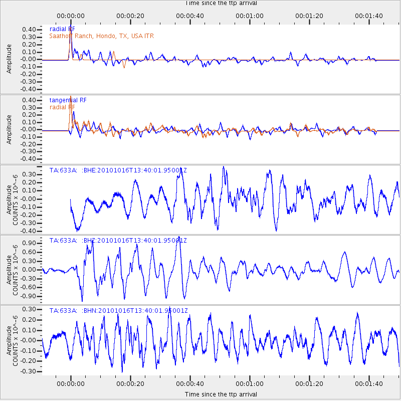
633A Saathoff Ranch, Hondo, TX, USA - Earthquake Result Viewer
*The percent match for this event was below the threshold and hence no stack was calculated.
| Earthquake location: |
Tonga Islands |
| Earthquake latitude/longitude: |
-20.5/-173.9 |
| Earthquake time(UTC): |
2010/10/16 (289) 13:27:45 GMT |
| Earthquake Depth: |
7.4 km |
| Earthquake Magnitude: |
5.7 MB, 5.7 MS, 5.6 MW, 5.6 MW |
| Earthquake Catalog/Contributor: |
WHDF/NEIC |
|
| Network: |
TA USArray Transportable Network (new EarthScope stations) |
| Station: |
633A Saathoff Ranch, Hondo, TX, USA |
| Lat/Lon: |
29.46 N/99.18 W |
| Elevation: |
320 m |
|
| Distance: |
87.4 deg |
| Az: |
57.376 deg |
| Baz: |
244.897 deg |
| Ray Param: |
$rayparam |
*The percent match for this event was below the threshold and hence was not used in the summary stack. |
|
| Radial Match: |
71.03149 % |
| Radial Bump: |
400 |
| Transverse Match: |
66.04112 % |
| Transverse Bump: |
368 |
| SOD ConfigId: |
339645 |
| Insert Time: |
2011-02-17 07:53:52.531 +0000 |
| GWidth: |
2.5 |
| Max Bumps: |
400 |
| Tol: |
0.001 |
|
Signal To Noise
| Channel | StoN | STA | LTA |
| TA:633A: :BHZ:20101016T13:40:01.95001Z | 3.7708933 | 3.668534E-7 | 9.728554E-8 |
| TA:633A: :BHN:20101016T13:40:01.95001Z | 1.3456955 | 1.1320926E-7 | 8.412695E-8 |
| TA:633A: :BHE:20101016T13:40:01.95001Z | 0.9985607 | 1.3729611E-7 | 1.37494E-7 |
| Arrivals |
| Ps | |
| PpPs | |
| PsPs/PpSs | |


