You are here: Home > Network List > US - United States National Seismic Network Stations List
> Station HLID Hailey, Idaho, USA > Earthquake Result Viewer
HLID Hailey, Idaho, USA - Earthquake Result Viewer
*The percent match for this event was below the threshold and hence no stack was calculated.
| Earthquake location: |
Tonga Islands |
| Earthquake latitude/longitude: |
-20.5/-173.9 |
| Earthquake time(UTC): |
2010/10/16 (289) 13:27:45 GMT |
| Earthquake Depth: |
7.4 km |
| Earthquake Magnitude: |
5.7 MB, 5.7 MS, 5.6 MW, 5.6 MW |
| Earthquake Catalog/Contributor: |
WHDF/NEIC |
|
| Network: |
US United States National Seismic Network |
| Station: |
HLID Hailey, Idaho, USA |
| Lat/Lon: |
43.56 N/114.41 W |
| Elevation: |
1772 m |
|
| Distance: |
83.8 deg |
| Az: |
39.05 deg |
| Baz: |
234.355 deg |
| Ray Param: |
$rayparam |
*The percent match for this event was below the threshold and hence was not used in the summary stack. |
|
| Radial Match: |
79.66255 % |
| Radial Bump: |
400 |
| Transverse Match: |
69.91493 % |
| Transverse Bump: |
400 |
| SOD ConfigId: |
339645 |
| Insert Time: |
2011-02-17 07:58:49.775 +0000 |
| GWidth: |
2.5 |
| Max Bumps: |
400 |
| Tol: |
0.001 |
|
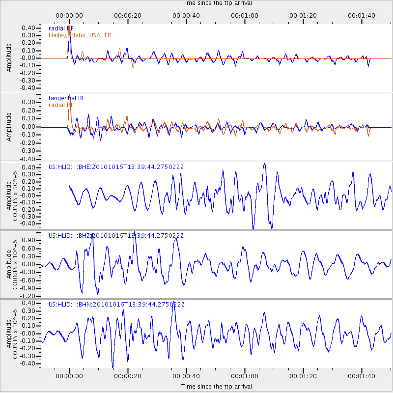
Signal To Noise
| Channel | StoN | STA | LTA |
| US:HLID: :BHZ:20101016T13:39:44.275022Z | 7.195482 | 4.384609E-7 | 6.0935584E-8 |
| US:HLID: :BHN:20101016T13:39:44.275022Z | 1.8411932 | 1.3120523E-7 | 7.126097E-8 |
| US:HLID: :BHE:20101016T13:39:44.275022Z | 1.5004679 | 1.3961585E-7 | 9.304821E-8 |
| Arrivals |
| Ps | |
| PpPs | |
| PsPs/PpSs | |


