You are here: Home > Network List > US - United States National Seismic Network Stations List
> Station HAWA Hanford, Washington, USA > Earthquake Result Viewer
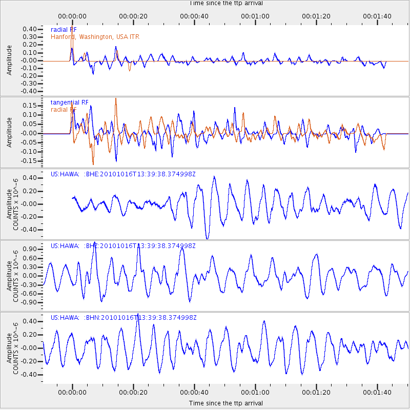
HAWA Hanford, Washington, USA - Earthquake Result Viewer
*The percent match for this event was below the threshold and hence no stack was calculated.
| Earthquake location: |
Tonga Islands |
| Earthquake latitude/longitude: |
-20.5/-173.9 |
| Earthquake time(UTC): |
2010/10/16 (289) 13:27:45 GMT |
| Earthquake Depth: |
7.4 km |
| Earthquake Magnitude: |
5.7 MB, 5.7 MS, 5.6 MW, 5.6 MW |
| Earthquake Catalog/Contributor: |
WHDF/NEIC |
|
| Network: |
US United States National Seismic Network |
| Station: |
HAWA Hanford, Washington, USA |
| Lat/Lon: |
46.39 N/119.53 W |
| Elevation: |
364 m |
|
| Distance: |
82.7 deg |
| Az: |
34.56 deg |
| Baz: |
230.22 deg |
| Ray Param: |
$rayparam |
*The percent match for this event was below the threshold and hence was not used in the summary stack. |
|
| Radial Match: |
55.03039 % |
| Radial Bump: |
400 |
| Transverse Match: |
63.697205 % |
| Transverse Bump: |
400 |
| SOD ConfigId: |
339645 |
| Insert Time: |
2011-02-17 07:58:55.812 +0000 |
| GWidth: |
2.5 |
| Max Bumps: |
400 |
| Tol: |
0.001 |
|
Signal To Noise
| Channel | StoN | STA | LTA |
| US:HAWA: :BHZ:20101016T13:39:38.374998Z | 2.1206617 | 3.40393E-7 | 1.6051263E-7 |
| US:HAWA: :BHN:20101016T13:39:38.374998Z | 1.1956853 | 1.5146466E-7 | 1.2667603E-7 |
| US:HAWA: :BHE:20101016T13:39:38.374998Z | 1.4272035 | 1.0159234E-7 | 7.1182804E-8 |
| Arrivals |
| Ps | |
| PpPs | |
| PsPs/PpSs | |


