You are here: Home > Network List > US - United States National Seismic Network Stations List
> Station EGMT Eagleton, Montana, USA > Earthquake Result Viewer
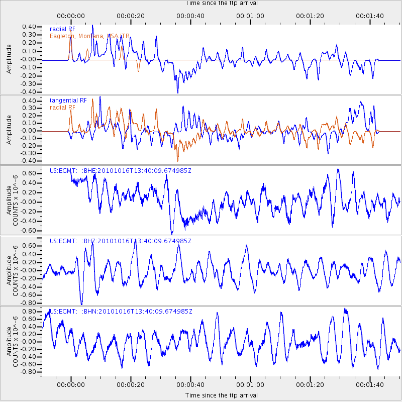
EGMT Eagleton, Montana, USA - Earthquake Result Viewer
*The percent match for this event was below the threshold and hence no stack was calculated.
| Earthquake location: |
Tonga Islands |
| Earthquake latitude/longitude: |
-20.5/-173.9 |
| Earthquake time(UTC): |
2010/10/16 (289) 13:27:45 GMT |
| Earthquake Depth: |
7.4 km |
| Earthquake Magnitude: |
5.7 MB, 5.7 MS, 5.6 MW, 5.6 MW |
| Earthquake Catalog/Contributor: |
WHDF/NEIC |
|
| Network: |
US United States National Seismic Network |
| Station: |
EGMT Eagleton, Montana, USA |
| Lat/Lon: |
48.02 N/109.75 W |
| Elevation: |
1055 m |
|
| Distance: |
89.0 deg |
| Az: |
37.176 deg |
| Baz: |
237.571 deg |
| Ray Param: |
$rayparam |
*The percent match for this event was below the threshold and hence was not used in the summary stack. |
|
| Radial Match: |
38.95867 % |
| Radial Bump: |
400 |
| Transverse Match: |
34.51043 % |
| Transverse Bump: |
400 |
| SOD ConfigId: |
339645 |
| Insert Time: |
2011-02-17 07:59:31.871 +0000 |
| GWidth: |
2.5 |
| Max Bumps: |
400 |
| Tol: |
0.001 |
|
Signal To Noise
| Channel | StoN | STA | LTA |
| US:EGMT: :BHZ:20101016T13:40:09.674985Z | 3.9529645 | 3.5900575E-7 | 9.081937E-8 |
| US:EGMT: :BHN:20101016T13:40:09.674985Z | 0.49292174 | 2.360354E-7 | 4.7884964E-7 |
| US:EGMT: :BHE:20101016T13:40:09.674985Z | 2.167103 | 4.379666E-7 | 2.0209774E-7 |
| Arrivals |
| Ps | |
| PpPs | |
| PsPs/PpSs | |


