You are here: Home > Network List > UW - Pacific Northwest Regional Seismic Network Stations List
> Station LEBA Lebam, WA, USA > Earthquake Result Viewer
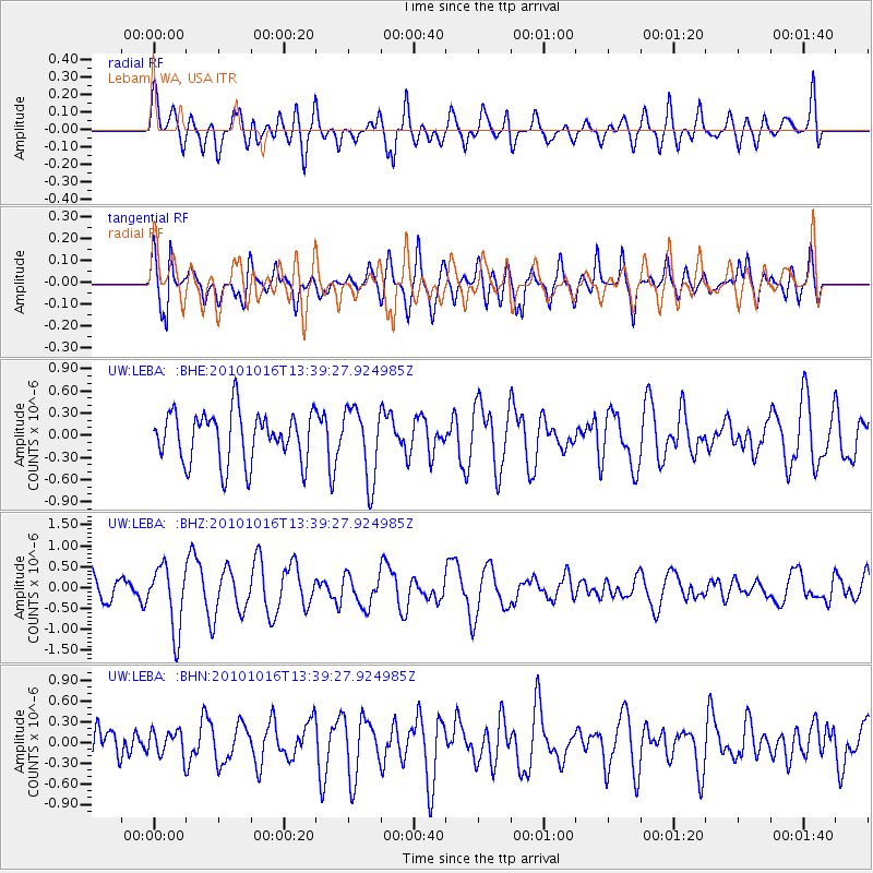
LEBA Lebam, WA, USA - Earthquake Result Viewer
*The percent match for this event was below the threshold and hence no stack was calculated.
| Earthquake location: |
Tonga Islands |
| Earthquake latitude/longitude: |
-20.5/-173.9 |
| Earthquake time(UTC): |
2010/10/16 (289) 13:27:45 GMT |
| Earthquake Depth: |
7.4 km |
| Earthquake Magnitude: |
5.7 MB, 5.7 MS, 5.6 MW, 5.6 MW |
| Earthquake Catalog/Contributor: |
WHDF/NEIC |
|
| Network: |
UW Pacific Northwest Regional Seismic Network |
| Station: |
LEBA Lebam, WA, USA |
| Lat/Lon: |
46.55 N/123.56 W |
| Elevation: |
73 m |
|
| Distance: |
80.7 deg |
| Az: |
32.583 deg |
| Baz: |
227.021 deg |
| Ray Param: |
$rayparam |
*The percent match for this event was below the threshold and hence was not used in the summary stack. |
|
| Radial Match: |
62.615364 % |
| Radial Bump: |
400 |
| Transverse Match: |
53.54185 % |
| Transverse Bump: |
400 |
| SOD ConfigId: |
339645 |
| Insert Time: |
2011-02-17 08:00:14.900 +0000 |
| GWidth: |
2.5 |
| Max Bumps: |
400 |
| Tol: |
0.001 |
|
Signal To Noise
| Channel | StoN | STA | LTA |
| UW:LEBA: :BHZ:20101016T13:39:27.924985Z | 2.6670222 | 7.67156E-7 | 2.8764512E-7 |
| UW:LEBA: :BHN:20101016T13:39:27.924985Z | 0.73121923 | 1.8065649E-7 | 2.47062E-7 |
| UW:LEBA: :BHE:20101016T13:39:27.924985Z | 1.4208573 | 4.8200116E-7 | 3.3923263E-7 |
| Arrivals |
| Ps | |
| PpPs | |
| PsPs/PpSs | |


