You are here: Home > Network List > TA - USArray Transportable Network (new EarthScope stations) Stations List
> Station W41B Gary Mavity, Velonia, AR, USA > Earthquake Result Viewer
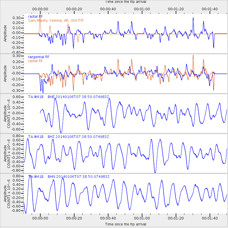
W41B Gary Mavity, Velonia, AR, USA - Earthquake Result Viewer
*The percent match for this event was below the threshold and hence no stack was calculated.
| Earthquake location: |
Kuril Islands |
| Earthquake latitude/longitude: |
46.2/152.1 |
| Earthquake time(UTC): |
2014/01/06 (006) 07:27:20 GMT |
| Earthquake Depth: |
100 km |
| Earthquake Magnitude: |
3.5 mb |
| Earthquake Catalog/Contributor: |
ISC/ISC |
|
| Network: |
TA USArray Transportable Network (new EarthScope stations) |
| Station: |
W41B Gary Mavity, Velonia, AR, USA |
| Lat/Lon: |
35.17 N/92.25 W |
| Elevation: |
95 m |
|
| Distance: |
80.4 deg |
| Az: |
48.51 deg |
| Baz: |
320.572 deg |
| Ray Param: |
$rayparam |
*The percent match for this event was below the threshold and hence was not used in the summary stack. |
|
| Radial Match: |
48.474884 % |
| Radial Bump: |
400 |
| Transverse Match: |
48.41979 % |
| Transverse Bump: |
397 |
| SOD ConfigId: |
3390531 |
| Insert Time: |
2019-04-09 21:52:04.706 +0000 |
| GWidth: |
2.5 |
| Max Bumps: |
400 |
| Tol: |
0.001 |
|
Signal To Noise
| Channel | StoN | STA | LTA |
| TA:W41B: :BHZ:20140106T07:38:50.074983Z | 1.0030128 | 3.1626627E-7 | 3.153163E-7 |
| TA:W41B: :BHN:20140106T07:38:50.074983Z | 0.5159179 | 2.0931635E-7 | 4.0571638E-7 |
| TA:W41B: :BHE:20140106T07:38:50.074983Z | 0.64317995 | 1.7296155E-7 | 2.6891624E-7 |
| Arrivals |
| Ps | |
| PpPs | |
| PsPs/PpSs | |


